


Will the red-hot microblogging platform Twitter change the way we live in our cities, how we call for help in an emergency, or even help rally a group to topple the city's government? Or is it a frivolous technology that simply atomizes our thoughts and relationships into 140-character bits?

Will the red-hot microblogging platform Twitter change the way we live in our cities, how we call for help in an emergency, or even help rally a group to topple the city's government? Or is it a frivolous technology that simply atomizes our thoughts and relationships into 140-character bits?
In order for Twitter to impact a local area, it must have some sort of geographic search. Unlike the now-defunct Twitter-like service Dodgeball (which notified your friends if they were physically nearby), Twitter itself has no geographic index save self-reported locations in user profiles. However, users got around that through a number of third party applications. The just-launched Localtweeps.com looks to be the most promising geographic directory of Twitter users yet.
Of course, just because it wasn't designed to support local communities didn't mean it hasn't been used that way. As an example of what we should perhaps call a placetweeter, 02138now ("Harvard Square Now!") has issued 1,284 updates, generally retweets from other members, about goings on in Harvard Square in Cambridge, Massachusetts. Any incident involving police or other emergency responders sparks a flurry of tweets reporting speculated or actual causes.
Groups of friends already living in proximity logically use Twitter to stay in touch, so much so that after a mugging an acquaintance of mine who lives in Washington, D.C. used Twitter to ask for help. Three friends dialed 911 for her. Nevertheless, in response to a blog post on the incident the tweet author writes, "you're obviously welcome to have any opinion you like, but it's also not something I sat down and logically plotted out, I was running inside in a panic, and I did what I did. I wouldn't take it as some thesis I wrote on the amazing uses of twitter."
Beyond the subtle influence on urban community life, could Twitter have much more obvious impacts on the way we live in cities? Fellow Planetizen blogger Anthony Townsend reports of a Twitter application helping hungry New Yorkers keep tabs on the notoriously long line at a popular burger stand. On a more ominous note, according to today's New York Times, social media like Twitter and Facebook played some role in rallying an unexpectedly large crowd for a anti-government protest that turned violent in Moldova.
Of course, Twitter could change policy through the more sedate and conventional channel of urban plan making. The regional planning agency the Chicago Metropolitan Agency for Planning has set up a Twitter feed to solicit input as part of their Go To 2040 planning initiative, posting tweets on topics like U.S. Census data and federal earmarks affecting Chicago.
I'm not sure what these loosely connected items amount to. Maybe we can discuss it via Twitter at the upcoming American Planning Association conference. How does #apa09 sound for the event hashtag?


Is Twitter Still an Effective Planning Tool?
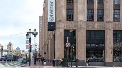
Twitter has been a daily dose of drama and upheaval ever since Elon Musk offered to pay over $40 billion to buy the social media platform. Media outlets and public transit agencies had been abandoning the social media platform—should planners?

Transit Agencies Could Lose Access to Twitter Updates
Twitter announced it would start charging for access to its API, which many transit and government agencies rely on to provide real-time service updates.
City Requiring Permits for Twitter’s Dystopian Office Bedrooms
After a Forbes article revealed dozens of makeshift sleeping areas in Twitter’s downtown San Francisco offices, the city is asking the company to file for permits if they want to keep them.

Planetizen Federal Action Tracker
A weekly monitor of how Trump’s orders and actions are impacting planners and planning in America.

Restaurant Patios Were a Pandemic Win — Why Were They so Hard to Keep?
Social distancing requirements and changes in travel patterns prompted cities to pilot new uses for street and sidewalk space. Then it got complicated.

Map: Where Senate Republicans Want to Sell Your Public Lands
For public land advocates, the Senate Republicans’ proposal to sell millions of acres of public land in the West is “the biggest fight of their careers.”

Maui's Vacation Rental Debate Turns Ugly
Verbal attacks, misinformation campaigns and fistfights plague a high-stakes debate to convert thousands of vacation rentals into long-term housing.

San Francisco Suspends Traffic Calming Amidst Record Deaths
Citing “a challenging fiscal landscape,” the city will cease the program on the heels of 42 traffic deaths, including 24 pedestrians.

California Homeless Arrests, Citations Spike After Ruling
An investigation reveals that anti-homeless actions increased up to 500% after Grants Pass v. Johnson — even in cities claiming no policy change.
Urban Design for Planners 1: Software Tools
This six-course series explores essential urban design concepts using open source software and equips planners with the tools they need to participate fully in the urban design process.
Planning for Universal Design
Learn the tools for implementing Universal Design in planning regulations.
Heyer Gruel & Associates PA
JM Goldson LLC
Custer County Colorado
City of Camden Redevelopment Agency
City of Astoria
Transportation Research & Education Center (TREC) at Portland State University
Camden Redevelopment Agency
City of Claremont
Municipality of Princeton (NJ)