


Jeff Speck takes a walk in Oklahoma City and finds too-wide streets, too-low density and too much danger for pedestrians.
"Streets getting the most critical eye from Speck include Hudson Avenue between Reno Avenue and Robert S. Kerr Avenue. Those trying to cross the six-lane street Thursday included Henry Jerome, 34, who was on his way to the Oklahoma County Courthouse."
"'This is why I don't come downtown,' Jerome said. 'I thought parking would be bad, but it really wasn't. But this street - it's ridiculous. And all these one-way streets are scary. Why does it have to be this way?'"
"According to Speck, it doesn't. Speck showed the downtown street configurations to traffic engineers outside the state and their first response was to guess the street grid was set up for a downtown density and traffic volume comparable to Chicago or Manhattan."
"'They said this is a street network that will support three to four times the density it is handling,' Speck said. 'Then you look at the traffic counts, and only a few carrying 10,000 a day. And 10,000 cars a day is easily handled by a two-lane road.'"
Thanks to ArchNewsNow
FULL STORY: Oklahoma City streets not made for walking, design consultant concludes


Opinion: What San Francisco’s Proposed ‘Family Zoning’ Could Really Mean
Mayor Lurie is using ‘family zoning’ to encourage denser development and upzoning — but could the concept actually foster community and more human-scale public spaces?
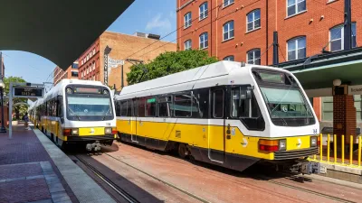
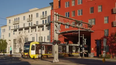
North Texas Transit Leaders Tout Benefits of TOD for Growing Region
At a summit focused on transit-oriented development, policymakers discussed how North Texas’ expanded light rail system can serve as a tool for economic growth.
California Bill Aims to Boost TOD
A bill proposed by Sen. Scott Wiener would exempt transit agencies from zoning rules near ‘high-quality’ transit stops and allow denser transit-oriented development.

Maui's Vacation Rental Debate Turns Ugly
Verbal attacks, misinformation campaigns and fistfights plague a high-stakes debate to convert thousands of vacation rentals into long-term housing.

Planetizen Federal Action Tracker
A weekly monitor of how Trump’s orders and actions are impacting planners and planning in America.

Chicago’s Ghost Rails
Just beneath the surface of the modern city lie the remnants of its expansive early 20th-century streetcar system.

Bend, Oregon Zoning Reforms Prioritize Small-Scale Housing
The city altered its zoning code to allow multi-family housing and eliminated parking mandates citywide.

Amtrak Cutting Jobs, Funding to High-Speed Rail
The agency plans to cut 10 percent of its workforce and has confirmed it will not fund new high-speed rail projects.

LA Denies Basic Services to Unhoused Residents
The city has repeatedly failed to respond to requests for trash pickup at encampment sites, and eliminated a program that provided mobile showers and toilets.
Urban Design for Planners 1: Software Tools
This six-course series explores essential urban design concepts using open source software and equips planners with the tools they need to participate fully in the urban design process.
Planning for Universal Design
Learn the tools for implementing Universal Design in planning regulations.
planning NEXT
Appalachian Highlands Housing Partners
Mpact (founded as Rail~Volution)
City of Camden Redevelopment Agency
City of Astoria
City of Portland
City of Laramie