


Cartographer Mark Newman's new book, 'The Atlas of the Real World', includes maps that show more than just 'how many acres there are in a country.' Malaria cases and health care spending per capita are among some of Newman's unconventional maps.
"'Maps can be misleading, absolutely," says Mark Newman of the University of Michigan, who is a co-author of the book The Atlas of the Real World: Mapping the Way We Live. "Your standard map of the world makes the North Pole look huge and the equator look very small. And we just accept it the way it is.'"
"Newman is perhaps best known for his electoral maps. Traditionally, the view is a virtual sea of red through the middle of the country, flanked by blue coasts. Looking at big red Montana, one may think it has much more influence than little blue New York – a third of Montana's size.
The reality is that New York has more than 10 times the number of electoral votes, because its population is so much bigger."
"Newman's new book takes this concept and applies it to the entire globe. On a map of car exports per capita, for example, Japan becomes gigantic - bigger than most continents - by virtue of its vast numbers of automobile exports."
Thanks to Franny Ritchie


More Passenger Rail Coming to Montana
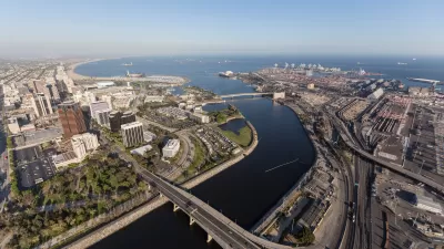
Planning is underway to restore a 45-year-defunct regional passenger rail line connecting southern Montana to Billings and Amtrak’s east-west Empire Builder line from Seattle to Chicago.

Elevating the ‘Small Stuff’ in Urban Design
Chuck Wolfe recaps arguments in favor of increased attention to incidentals — from benches to bollards — in urban development practices.
Los Angeles County Initiates Effort to Advance Equity in Infrastructure
L.A. County Public Works has launched an initiative to center equity in all of its processes, programming, and services as it plans, designs, builds, and maintains modern infrastructure that uplifts all communities of the county.

Maui's Vacation Rental Debate Turns Ugly
Verbal attacks, misinformation campaigns and fistfights plague a high-stakes debate to convert thousands of vacation rentals into long-term housing.

Planetizen Federal Action Tracker
A weekly monitor of how Trump’s orders and actions are impacting planners and planning in America.

San Francisco Suspends Traffic Calming Amidst Record Deaths
Citing “a challenging fiscal landscape,” the city will cease the program on the heels of 42 traffic deaths, including 24 pedestrians.

Defunct Pittsburgh Power Plant to Become Residential Tower
A decommissioned steam heat plant will be redeveloped into almost 100 affordable housing units.

Trump Prompts Restructuring of Transportation Research Board in “Unprecedented Overreach”
The TRB has eliminated more than half of its committees including those focused on climate, equity, and cities.

Amtrak Rolls Out New Orleans to Alabama “Mardi Gras” Train
The new service will operate morning and evening departures between Mobile and New Orleans.
Urban Design for Planners 1: Software Tools
This six-course series explores essential urban design concepts using open source software and equips planners with the tools they need to participate fully in the urban design process.
Planning for Universal Design
Learn the tools for implementing Universal Design in planning regulations.
Heyer Gruel & Associates PA
JM Goldson LLC
Custer County Colorado
City of Camden Redevelopment Agency
City of Astoria
Transportation Research & Education Center (TREC) at Portland State University
Jefferson Parish Government
Camden Redevelopment Agency
City of Claremont