


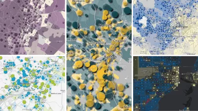
Cops in Toronto catch a criminal through GIS plotting, and reporter Sara Barbour takes us on a tour of other unusual new applications of GIS.
"At 10:30 one morning in late 2006, two police officers in the city of Toronto parked several blocks away from a nearby school. To passers-by, the police car appeared to have stopped at random; in fact, the pair's location was carefully planned based on months' worth of data. When a white van passed less than half an hour later, the officers cautiously followed it before signaling the driver to pull over.
By 11:03 a.m., the driver - a sex offender who had been harassing children in the area for more than a year - was under arrest.
For Manny San Pedro, detective constable and geographic profiling analyst for the Toronto Police, the 33-minute capture is the perfect case to demonstrate how geographic information systems (GIS) are putting officers in a position to solve crime - and just one example of how spatial thinking is changing the way we work today."
FULL STORY: GIS: Cops Favor New Kind of Plotting


Trump Cuts Decimate Mapping Agency
The National Geodetic Survey maintains and updates critical spatial reference systems used extensively in both the public and private sectors.
Explore US Demographics With the New ACS Atlas Collection
Esri's new ACS Atlas Collection offers interactive applications that visualize the latest U.S. demographic and socio-economic data, enabling users to explore over 175 curated web maps across various thematic areas.

Fighting Forest Pests With AI: A Hemlock Success Story
Fairfax County utilized GeoAI and ArcGIS technology to efficiently map and protect its hemlock trees from the invasive woolly adelgid, ensuring targeted pest management and preservation of its evergreen canopy.

Maui's Vacation Rental Debate Turns Ugly
Verbal attacks, misinformation campaigns and fistfights plague a high-stakes debate to convert thousands of vacation rentals into long-term housing.

Planetizen Federal Action Tracker
A weekly monitor of how Trump’s orders and actions are impacting planners and planning in America.

In Urban Planning, AI Prompting Could be the New Design Thinking
Creativity has long been key to great urban design. What if we see AI as our new creative partner?

King County Supportive Housing Program Offers Hope for Unhoused Residents
The county is taking a ‘Housing First’ approach that prioritizes getting people into housing, then offering wraparound supportive services.

Researchers Use AI to Get Clearer Picture of US Housing
Analysts are using artificial intelligence to supercharge their research by allowing them to comb through data faster. Though these AI tools can be error prone, they save time and housing researchers are optimistic about the future.

Making Shared Micromobility More Inclusive
Cities and shared mobility system operators can do more to include people with disabilities in planning and operations, per a new report.
Urban Design for Planners 1: Software Tools
This six-course series explores essential urban design concepts using open source software and equips planners with the tools they need to participate fully in the urban design process.
Planning for Universal Design
Learn the tools for implementing Universal Design in planning regulations.
planning NEXT
Appalachian Highlands Housing Partners
Mpact (founded as Rail~Volution)
City of Camden Redevelopment Agency
City of Astoria
City of Portland
City of Laramie