


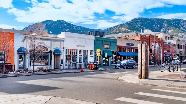
Once every few semesters, I teach a seminar on "Sprawl and the Law." On the first day of the seminar, I ask students what "sprawl" is. After getting a variety of answers, I reveal the truth: most definitions of sprawl involve one of two separate definitions: "Where we grow"- Sprawl as movement from the core to the fringe of a region. "How we grow"- Sprawl as development oriented towards drivers as opposed to nondrivers.

Once every few semesters, I teach a seminar on "Sprawl and the Law." On the first day of the seminar, I ask students what "sprawl" is. After getting a variety of answers, I reveal the truth: most definitions of sprawl involve one of two separate definitions:
"Where we grow"- Sprawl as movement from the core to the fringe of a region.
"How we grow"- Sprawl as development oriented towards drivers as opposed to nondrivers.
Often, the two go together: a car-oriented development 20 miles from downtown is certainly "sprawl" by either definition. But a new urbanist development in an outer suburb (such as Celebration or Kentlands) is sprawl in the first sense ("Where") but not in the second ("How.") On the other hand, in car-oriented cities like Atlanta and Jacksonville, there are car-oriented neighborhoods built in the 1940s and 1950s- some as few as four or five miles from downtown. These places are sprawl in the second sense ("How") but not in the first ("Where").
Policymakers who wish to limit sprawl must adopt different policies to deal with each type of sprawl. Urban growth boundaries and farmland preservation limit suburban growth and thus affect "Where we grow" sprawl- but do nothing to affect "How we grow" sprawl. "How we grow" sprawl, by contrast, is not going to be affected by limitations on overall suburban growth. The most effective way to limit this type of sprawl is through density, diversity, and design- encouraging compact, mixed-use, pedestrian-oriented development in city and suburb alike.

Shedding Light on the Creeping Costs of Sprawl
Studies comparing tax revenues from a per-acre perspective show significant gains for municipalities with dense, mixed-use development.
Boulder Eliminates Parking Minimums Citywide
Officials estimate the cost of building a single underground parking space at up to $100,000.
Orange County, Florida Adopts Largest US “Sprawl Repair” Code
The ‘Orange Code’ seeks to rectify decades of sprawl-inducing, car-oriented development.

Planetizen Federal Action Tracker
A weekly monitor of how Trump’s orders and actions are impacting planners and planning in America.

Chicago’s Ghost Rails
Just beneath the surface of the modern city lie the remnants of its expansive early 20th-century streetcar system.

San Antonio and Austin are Fusing Into one Massive Megaregion
The region spanning the two central Texas cities is growing fast, posing challenges for local infrastructure and water supplies.

Since Zion's Shuttles Went Electric “The Smog is Gone”
Visitors to Zion National Park can enjoy the canyon via the nation’s first fully electric park shuttle system.

Trump Distributing DOT Safety Funds at 1/10 Rate of Biden
Funds for Safe Streets and other transportation safety and equity programs are being held up by administrative reviews and conflicts with the Trump administration’s priorities.

German Cities Subsidize Taxis for Women Amid Wave of Violence
Free or low-cost taxi rides can help women navigate cities more safely, but critics say the programs don't address the root causes of violence against women.
Urban Design for Planners 1: Software Tools
This six-course series explores essential urban design concepts using open source software and equips planners with the tools they need to participate fully in the urban design process.
Planning for Universal Design
Learn the tools for implementing Universal Design in planning regulations.
planning NEXT
Appalachian Highlands Housing Partners
Mpact (founded as Rail~Volution)
City of Camden Redevelopment Agency
City of Astoria
City of Portland
City of Laramie