


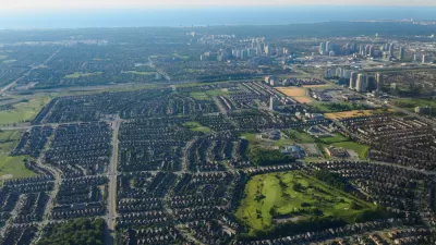
A new report praises Ontario's greenbelt - 11 times the size of Toronto - as a model for urban growth control.
"The loss of prime agricultural land near cities due to urban sprawl is bemoaned the world over as a modern blight. But a solution may be at hand, for which Toronto should be recognized as a world leader: greenbelts, or farmland and environmentally sensitive land that has been officially made off limits to developers.
A study being released today says the zone of protected land around Toronto is not only one of the largest greenbelts in the world, but is also superior to ones in North America and Europe.
'Ontario's greenbelt is positioned to be the most successful and most useful greenbelt in the world,' concluded the study, compiled by the Canadian Institute for Environmental Law and Policy, a Toronto-based think tank. In making the assessment, the institute looked in detail at B.C.'s agricultural land reserve, one of the first efforts to curb sprawl in North America; Oregon's urban growth boundary; the unusual greenbelt that Germany is developing in the former no-man's land along the Iron Curtain; and the famed greenbelts around London and near Amsterdam. It dismissed as a "failure" the greenbelt around the Ottawa region assembled by the National Capital Commission, suggesting it has facilitated rather than hindered urban sprawl.
The study says farmers should be compensated 'financially for implementing environmental stewardship activities that benefit everyone.'
As well, governments need to encourage the consumption of food grown in the greenbelt through farmers markets and promoting crops that appeal to Canada's growing visible minority population.
The study will be submitted to the province as part of a consultation process by the ministry of municipal affairs on ways municipalities near Toronto can have some of their remaining rural countryside included in the greenbelt."
FULL STORY: Ontario's greenbelt a model for the world

Nowhere to Build but Up
An old way of doing municipal business—generating development fees by opening farmland to development—is no longer paying dividends. Mississauga, Ontario serves as a cautionary tale for the bottom line of sprawl.
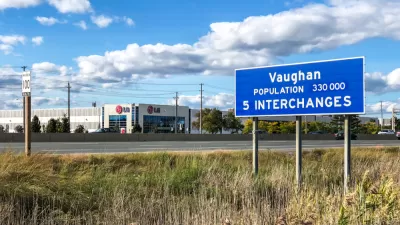
Council Votes to Allow Development on the York Region's Greenbelt
The York Regional Council took a significant step toward allowing development on a large chunk of the area's greenbelt—a move opponents say will set a dangerous precedent.
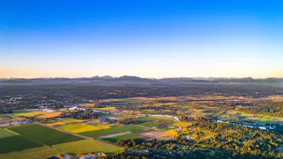
Snohomish County, Washington, Sets its Sights on Sprawl
Advocates say it’s unnecessary, but Snohomish County is preparing to expand its urban growth areas to allow for more low density residential development.

Planetizen Federal Action Tracker
A weekly monitor of how Trump’s orders and actions are impacting planners and planning in America.

Restaurant Patios Were a Pandemic Win — Why Were They so Hard to Keep?
Social distancing requirements and changes in travel patterns prompted cities to pilot new uses for street and sidewalk space. Then it got complicated.

Maui's Vacation Rental Debate Turns Ugly
Verbal attacks, misinformation campaigns and fistfights plague a high-stakes debate to convert thousands of vacation rentals into long-term housing.

In California Battle of Housing vs. Environment, Housing Just Won
A new state law significantly limits the power of CEQA, an environmental review law that served as a powerful tool for blocking new development.

Boulder Eliminates Parking Minimums Citywide
Officials estimate the cost of building a single underground parking space at up to $100,000.

Orange County, Florida Adopts Largest US “Sprawl Repair” Code
The ‘Orange Code’ seeks to rectify decades of sprawl-inducing, car-oriented development.
Urban Design for Planners 1: Software Tools
This six-course series explores essential urban design concepts using open source software and equips planners with the tools they need to participate fully in the urban design process.
Planning for Universal Design
Learn the tools for implementing Universal Design in planning regulations.
Heyer Gruel & Associates PA
JM Goldson LLC
Custer County Colorado
City of Camden Redevelopment Agency
City of Astoria
Transportation Research & Education Center (TREC) at Portland State University
Jefferson Parish Government
Camden Redevelopment Agency
City of Claremont