Rapid population growth and limited pedestrian infrastructure puts people walking at higher risk.

Memphis is the nation’s most dangerous city for pedestrians, according to a study from a Texas law firm. The Tennessee city has the highest rate of pedestrian fatalities per capita, with 13.4 deaths per 100,000 people. “That’s a stark warning for anyone walking the streets of this Tennessee city,” writes Sarah Kennedy in Motor Biscuit.
Memphis has a walkability score of 35 — not the lowest of the cities analyzed. That distinction goes to Charlotte, North Carolina, with a walkability score of 26. Phoenix, a city with a walkability score of 41 that dedicates 16 percent of the city to parks and green spaces, has the highest raw number of pedestrian fatalities (117) or 7.1 deaths per 100,000. “It seems that even with plenty of green spaces, safety isn’t guaranteed. Sources cite a lack of infrastructure, like sidewalks or crosswalks, in high-traffic areas.”
In places like Phoenix and Charlotte, new pedestrian infrastructure has not kept up with rapid population growth that adds both foot and vehicle traffic to city streets.
FULL STORY: The most dangerous city in the US for pedestrians isn’t even the least walkable

Planetizen Federal Action Tracker
A weekly monitor of how Trump’s orders and actions are impacting planners and planning in America.

Silicon Valley ‘Bike Superhighway’ Awarded $14M State Grant
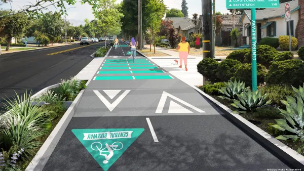
A Caltrans grant brings the 10-mile Central Bikeway project connecting Santa Clara and East San Jose closer to fruition.

Amtrak Cutting Jobs, Funding to High-Speed Rail
The agency plans to cut 10 percent of its workforce and has confirmed it will not fund new high-speed rail projects.

California Set to Increase Electric Truck Chargers by 25%
The California Transportation Commission approved funding for an additional 500 charging ports for electric trucks along some of the state’s busiest freight corridors.

21 Climate Resilience Projects Cancelled by the EPA
The federal government has pulled funding for at least 21 projects related to farming, food systems, and environmental justice to comply with one of Trump’s early executive orders.

Trump Executive Order on Homelessness Calls for Forced Institutionalization
The order seeks to remove legal precedents and consent decrees that prevent cities from moving unhoused people from the street to treatment centers.
Urban Design for Planners 1: Software Tools
This six-course series explores essential urban design concepts using open source software and equips planners with the tools they need to participate fully in the urban design process.
Planning for Universal Design
Learn the tools for implementing Universal Design in planning regulations.
Yukon Government
Caltrans
New Jersey Institute of Technology
Mpact (founded as Rail~Volution)
City of Camden Redevelopment Agency
City of Norman, Oklahoma
City of Portland
City of Laramie


