


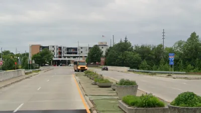
Sensors on specially equipped bikes can collect information on trail accessibility and pavement conditions to prioritize maintenance projects.

Bicycles equipped with data collection devices are helping communities understand the conditions of their bike lanes and paths, reports Daniel C. Vock for Route Fifty.
“Local planning organizations have deployed them in Idaho, Iowa, Massachusetts and Minnesota,” Vock adds. “The Des Moines area agency produces heat maps of where distressed pavement is located, which helps local governments identify the problem areas quickly.” In Des Moines, the city wants to map out all of the region’s pathways in two years.
Local governments can use this data to build more resilient trails and understand problem areas. Planners can use the information to prioritize areas for improvement when applying for grants and developing maintenance plans.
The technology isn’t without its challenges: “The devices on board also don’t record debris or the slope of the paths, which would also be helpful for devising maintenance plans. And they don’t capture branches growing over the path or other obstacles that could prevent cyclists from using the trail.”
FULL STORY: Rough ride? Data bikes chart the condition of bike paths in more cities

Indy Neighborhood Group Builds Temporary Multi-Use Path
Community members, aided in part by funding from the city, repurposed a vehicle lane to create a protected bike and pedestrian path for the summer season.

Queensboro Bridge Bike Lane Delayed Again
A project that would give pedestrians their own dedicated path on the crowded bridge has been pushed back to at least the summer of 2024.
New Cycling Initiatives in Ukraine
The city of Lviv in western Ukraine has begun a 9-year initiative to build 168 miles of bicycling infrastructure to the region.

Trump Administration Could Effectively End Housing Voucher Program
Federal officials are eyeing major cuts to the Section 8 program that helps millions of low-income households pay rent.

Planetizen Federal Action Tracker
A weekly monitor of how Trump’s orders and actions are impacting planners and planning in America.

Canada vs. Kamala: Whose Liberal Housing Platform Comes Out on Top?
As Canada votes for a new Prime Minister, what can America learn from the leading liberal candidate of its neighbor to the north?

Washington State’s Parking Reform Law Could Unlock ‘Countless’ Acres for New Housing
A law that limits how much parking cities can require for residential amd commercial developments could lead to a construction boom.

Wildlife Rebounds After the Eaton Fire
Following the devastation of the Eaton Fire, the return of wildlife and the regrowth of native plants are offering powerful signs of resilience and renewal.

LA to Replace Inglewood Light Rail Project With Bus Shuttles
LA Metro says the change is in response to community engagement and that the new design will be ready before the 2028 Olympic Games.
Urban Design for Planners 1: Software Tools
This six-course series explores essential urban design concepts using open source software and equips planners with the tools they need to participate fully in the urban design process.
Planning for Universal Design
Learn the tools for implementing Universal Design in planning regulations.
Central Transportation Planning Staff/Boston Region MPO
Heyer Gruel & Associates PA
Institute for Housing and Urban Development Studies (IHS)
City of Grandview
Harvard GSD Executive Education
Regional Transportation Commission of Southern Nevada
Toledo-Lucas County Plan Commissions