


The city’s streetcar line, defunct since 1974, is moving thousands of riders through a newly revitalized downtown.
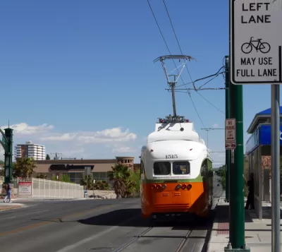
A historic streetcar line in El Paso is playing a role in the city’s downtown resurgence, writes Christian Betancourt in Next City.
The streetcar line was resurrected in 2019, and although it doesn’t run all the way to Ciudad Juarez, Mexico, like it once did, “it did serve 47,000 riders during the last fiscal year — at zero fare. In April, seven months into the current fiscal year, 55,000 riders were recorded.”
The article describes the process of getting the streetcars back online, which included a survey of local residents that revealed that “residents wanted the streetcar to be included among the 2012 Quality of life bond projects, which was overwhelmingly approved by voters.” The $97 million project was ultimately funded by the Texas Department of Transportation (TxDot) alone.
A key purpose for the streetcar, the article adds, is promoting more transit-oriented development (TOD) in dense parts of the city. “Beyond downtown revitalization, streetcar’s services are twofold: maintaining a regular route and timely schedule, while including fun programming for riders to enjoy. The streetcar hosts historic tours, readings and NPR Tiny Desk-inspired musical acts that welcome riders at each stop, with events lasting the 45 minutes it takes to complete the route.”
FULL STORY: How El Paso’s Streetcars Rose Again

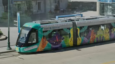
The Variable Benefits of Streetcars
An analysis of several streetcar systems shows that they bring different benefits based on a community’s goals.
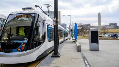
Kansas City Streetcar to Extend to Rockhurst
A new extension to the Kansas City Streetcar will open up the free transit line to Rockhurst University students.

Memphis Testing Vintage Siemens U2 Trolley Cars—With Service Expected to Open Later This Year
Originally designed for use in Frankfurt, Germany, the Siemens–Duewag U2 was used in Canada and San Diego before now coming to Memphis.

Montreal Mall to Become 6,000 Housing Units
Place Versailles will be transformed into a mixed-use complex over the next 25 years.

Planetizen Federal Action Tracker
A weekly monitor of how Trump’s orders and actions are impacting planners and planning in America.

DARTSpace Platform Streamlines Dallas TOD Application Process
The Dallas transit agency hopes a shorter permitting timeline will boost transit-oriented development around rail stations.

Study: 4% of Truckers Lack a Valid Commercial License
Over 56% of inspected trucks had other violations.

Chicago Judge Orders Thousands of Accessible Ped Signals
Only 3% of the city's crossing signals are currently accessible to blind pedestrians.

Philadelphia Swaps Car Lanes for Bikeways in Unanimous Vote
The project will transform one of the handful of streets responsible for 80% of the city’s major crashes.
Urban Design for Planners 1: Software Tools
This six-course series explores essential urban design concepts using open source software and equips planners with the tools they need to participate fully in the urban design process.
Planning for Universal Design
Learn the tools for implementing Universal Design in planning regulations.
City of Mt Shasta
City of Camden Redevelopment Agency
City of Astoria
Transportation Research & Education Center (TREC) at Portland State University
US High Speed Rail Association
City of Camden Redevelopment Agency
Municipality of Princeton (NJ)