A new database measures the restrictiveness of exclusionary zoning practices around the country. Exclusionary zoning, it turns out, is much more prevalent than commonly acknowledged.


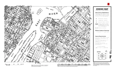
The Eviction Lab has created a new tool to document exclusionary zoning practices around the United States as a first step creating the new housing necessary to ease rising housing costs in communities.
Writing for the Eviction Lab, Matt Mleczko and Matthew Desmond introduce the challenge of reforming zoning when so little is known about zoning in the aggregate.
“Zoning is fundamental to the make-up of our communities and our neighborhoods, but understanding these regulations and how they vary within and between places is enormously challenging. In large part, that’s because we lack straightforward, nationwide data,” according to the article.
Mleczko, Desmond, and the team at the Eviction Lab are attempting to fill that void with the launch of the National Zoning and Land Use Database (NZLUD). The duo have also authored an article for the Urban Studies journal to describe the process of creating the NZLUD, and have shared their data and code on GitHub.
The process created a metric the team dubbed the Zoning Restrictiveness Index (ZRI) to compare the restrictiveness of development regulations across jurisdictions. “We find highly-restrictive zoning policies in some of the coastal metro areas you might expect—Washington DC, New York, Seattle—but also in rustbelt metro areas like Milwaukee and Detroit,” write Mleczko and Desmond. “This underscores that exclusionary zoning is more common than many have acknowledged, both across and within metro areas.”
As measured by the ZRI, the most restrictive metropolitan areas are 1) Washington-Arlington-Alexandria, DC-VA-MD-WV; 2) New York-Northern New Jersey-Long Island, NY-NJ-PA; 3) Providence-New Bedford-Fall River, RI-MA; 4) Seattle-Tacoma-Bellevue, WA; and 5) Tampa-St. Petersburg-Clearwater, FL.
The remainder of the top ten, which, perhaps shockingly, does not include any Californian metropolitan areas, can be found at the link below. Example maps of depicting ZRI quintiles for the San-Francisco-Oakland-Fremont metropolitan statistical area (MSA) and the Houston-Sugar Land-Baytown MSA are also included.
FULL STORY: To reform exclusionary zoning, we first need to document it. Now we have a tool for that.


Ohio Economists: Relax Zoning to Lower Housing Costs
A panel of Ohio economists make the case for more multi-family housing and businesses in single-family neighborhoods.

A Pro-Development Approach to Housing Affordability and Economic Growth
Decades of building housing on the fringes of metropolitan areas have mired the United States in a housing affordability crisis defined by a widening gap between the haves and the have nots.

Proposed Zoning Consolidation Scaled Back in Anchorage
A revised, scaled-back version of a zoning reform effort in Anchorage would concentrate the proposed consolidation of residential zoning districts in one part of the city.

Planetizen Federal Action Tracker
A weekly monitor of how Trump’s orders and actions are impacting planners and planning in America.

The state-sanctioned urbicide of Austin
People don’t kill cities. Freeways do.

US to reduce Colorado River water deliveries to Mexico
A new Colorado Treaty amendment reduces Mexico’s Colorado River water allocation by 250,000 acre feet.

5 New England states march closer to 800 megawatt wind energy project
Securing federal approval for the project may be complicated under the Trump administration, which has historically been hostile towards domestic wind power.

Baltimore to break ground on $50 million Transit Priority Project
The project will bring faster bus trips, safer streets and better bike connections to Baltimore.

Airbnb launches $250 million 'last-dollar financing' housing accelerator, makes first investment in Austin
The company will put $6.4 million towards affordable housing development in Texas’ capital.

FREE Course: Walkable City 1: Why Walkability?
After describing his path towards focusing on walkability as the essence of good planning, Jeff Speck marches through his five principal reasons for making more walkable places.
Reinventing Malls: Planning Alchemy—Turning Gray Fields Into Gold
The course focuses on the opportunities and imperatives that shape reinvention of mall sites.

Eagle County Government
Harvard University Graduate School of Design
Nashville Planning Department
The Architects Foundation
University of Cincinnati Online
The Pocatello Development Authority
The Urban Renewal Agency of the City of Pocatello
Journal of the American Planning Association