


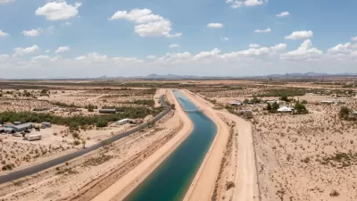
A new analysis of U.S. and Mexico groundwater supplies reveals 72 aquifers shared between the two countries.
A new map of groundwater supplies could change the shape of water management and conservation policy in the U.S. Southwest and Mexico, reports Caroline Tracey in High Country News. “On Dec. 28, researchers released the first complete map of the groundwater basins that span the U.S.-Mexico boundary. It demarcates 72 shared aquifers — a striking contrast to the countries’ official count of 11.”
The map comes from research by Rosario Sánchez and Laura Rodríguez published in Transboundary Aquifers: Challenges and the Way Forward. “It shows five shared aquifers between Baja California and California, 26 between Sonora and Arizona, and 33 between Texas and the Mexican states of Chihuahua, Coahuila, Nuevo León, and Tamaulipas. Of these, 45% are considered to be in ‘good to moderate’ condition.”
The two countries have not previously collaborated on water regulation efforts, leading to incongruous uses and unsustainable exploitation of water resources, Tracey explains. The research standardizes the definition of an aquifer, which the authors hope will contribute to a better shared understanding of the intertwined water resources in the two countries. “Felicia Marcus of the Water Policy Group added that maps like the one Sánchez and Rodríguez produced ‘are helpful for transparency and allow for more engagement of the affected communities,’ particularly in resolution of disputes.”
More on the Southwest's water crisis:
FULL STORY: Researchers solve one of the Borderlands’ biggest water puzzles

Arizona Governor Takes Steps to Modernize Water Policy
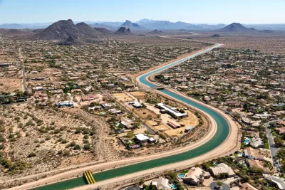
A newly released report warns of rapidly dwindling groundwater resources as developers plan to build hundreds of thousands of new homes.
Arizona’s Growth Threatens Water Supplies
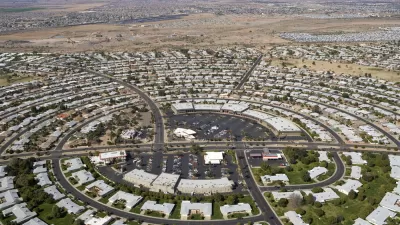
New communities are popping up across Arizona’s desert, evading water consumption restrictions and straining the state’s groundwater supplies.
Utah Debates Solutions to Water Shortage
With a rapidly growing population and strained water supplies, Utah lawmakers and conservation groups debate how to best replenish the state's water sources.

Maui's Vacation Rental Debate Turns Ugly
Verbal attacks, misinformation campaigns and fistfights plague a high-stakes debate to convert thousands of vacation rentals into long-term housing.

Planetizen Federal Action Tracker
A weekly monitor of how Trump’s orders and actions are impacting planners and planning in America.

In Urban Planning, AI Prompting Could be the New Design Thinking
Creativity has long been key to great urban design. What if we see AI as our new creative partner?

Massachusetts Budget Helps Close MBTA Budget Gap
The budget signed by Gov. Maura Healey includes $470 million in MBTA funding for the next fiscal year.

Milwaukee Launches Vision Zero Plan
Seven years after the city signed its Complete Streets Policy, the city is doubling down on its efforts to eliminate traffic deaths.

Portland Raises Parking Fees to Pay for Street Maintenance
The city is struggling to bridge a massive budget gap at the Bureau of Transportation, which largely depleted its reserves during the Civd-19 pandemic.
Urban Design for Planners 1: Software Tools
This six-course series explores essential urban design concepts using open source software and equips planners with the tools they need to participate fully in the urban design process.
Planning for Universal Design
Learn the tools for implementing Universal Design in planning regulations.
Gallatin County Department of Planning & Community Development
Heyer Gruel & Associates PA
JM Goldson LLC
City of Camden Redevelopment Agency
City of Astoria
Transportation Research & Education Center (TREC) at Portland State University
Jefferson Parish Government
Camden Redevelopment Agency
City of Claremont