


The growth of transit-oriented development in the Cleveland region is being hindered by zoning codes that limit housing density and excessive parking requirements that drive up construction costs, new research suggests.
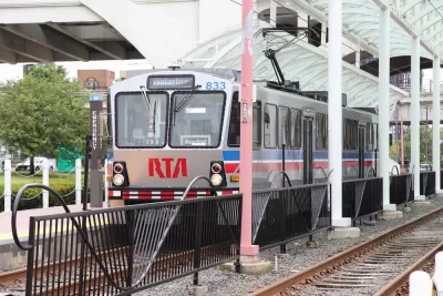
“New research by the Cuyahoga County Planning Commission offers fresh evidence that Cleveland and surrounding suburbs would be smart to rezone transit corridors to encourage dense, walkable, transit-oriented development, or TOD,” reports Steven Litt for Cleveland.com.
While market demand for transit-oriented development in Cleveland is growing, in many cases, developers still have to go through a cumbersome and expensive process to get permits to build TOD. “The data show that between 2012 and 2021, some 383 new developments added nearly $3 billion in real estate value through new construction or building renovations in the transit corridors.”While not every project is ‘transit-friendly,’ the study’s authors say “the new wave of development shows that to a significant extent, transit-oriented development is already happening in the core of the region because the market is demanding it.”
The research is part of an initiative to encourage transit-oriented development and assess how zoning changes can stimulate more housing production near transit lines. The four-phase project “will include identifying areas that could be targeted for transit-oriented development, drafting model codes, and identifying financial mechanisms and incentives.”
According to the study, the momentum for boosting development along transit in many Cleveland suburbs is stymied by outdated zoning codes and parking requirements, as well as disparate regulations among different suburbs. The authors suggest that Cuyahoga County could help suburbs develop their zoning plans with an eye to housing development, connectivity, and walkability. For its part, the county sees TOD as “an opportunity to add population and rebuild the tax base after decades of sprawl sapped its strength.”


California Bill Aims to Boost TOD
A bill proposed by Sen. Scott Wiener would exempt transit agencies from zoning rules near ‘high-quality’ transit stops and allow denser transit-oriented development.

New TOD Breaks Ground in Atlanta Area
The project will include over 500 housing units, commercial and retail space, and park spaces.

Opinion: California’s SB 79 Would Improve Housing Affordability and Transit Access
A proposed bill would legalize transit-oriented development statewide.

Montreal Mall to Become 6,000 Housing Units
Place Versailles will be transformed into a mixed-use complex over the next 25 years.

Planetizen Federal Action Tracker
A weekly monitor of how Trump’s orders and actions are impacting planners and planning in America.

DARTSpace Platform Streamlines Dallas TOD Application Process
The Dallas transit agency hopes a shorter permitting timeline will boost transit-oriented development around rail stations.

Study: 4% of Truckers Lack a Valid Commercial License
Over 56% of inspected trucks had other violations.

Chicago Judge Orders Thousands of Accessible Ped Signals
Only 3% of the city's crossing signals are currently accessible to blind pedestrians.

Philadelphia Swaps Car Lanes for Bikeways in Unanimous Vote
The project will transform one of the handful of streets responsible for 80% of the city’s major crashes.
Urban Design for Planners 1: Software Tools
This six-course series explores essential urban design concepts using open source software and equips planners with the tools they need to participate fully in the urban design process.
Planning for Universal Design
Learn the tools for implementing Universal Design in planning regulations.
City of Mt Shasta
City of Camden Redevelopment Agency
City of Astoria
Transportation Research & Education Center (TREC) at Portland State University
US High Speed Rail Association
City of Camden Redevelopment Agency
Municipality of Princeton (NJ)