


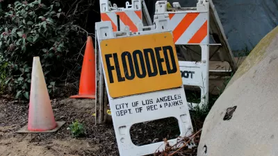
Recently revealed estimates put far more people in the region at risk for catastrophic flooding than previously thought.
The Los Angeles County Board of Supervisors wants to know how to shore up the region’s flood control infrastructure as experts predict “an increase in epic downpours” that could pose significant flood risk to many L.A. communities. Louis Sahagún reports on the story for the Los Angeles Times.
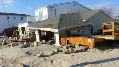
The supervisors are calling for a report from the Department of Public Works (DPW) detailing the state of existing infrastructure and plans for improving it. The motion comes in response to a recent study that highlighted the disproportionate risk faced by low-income communities of color. “The study’s unprecedented combination of high-resolution flood modeling and socioeconomic data indicates that major floods would occur between the Dominguez Channel on the west and the Los Angeles River on the east,” Sahagún writes, noting that the analysis put roughly 874,000 people and as much as $108 billion in property at risk for catastrophic flooding.
“Until recently, it was thought that a flood event of that magnitude was likely to occur every 1,000 to 10,000 years. New research, however, suggests that the chances of seeing another one of that scale over the next 40 years are about 50/50.” This makes the urgency of upgrading flood control and mitigation infrastructure more severe than previously thought. According to Mark Pestrella, director and chief engineer of the Los Angeles County Flood Control District, “The Board’s action today aligns with the county’s sustainable plan to make infrastructure improvements that reduce flood risk, increase local water supplies through stormwater capture and groundwater recharge, and improve water quality across the county.”
FULL STORY: Los Angeles County seeks flood control improvements in face of climate change

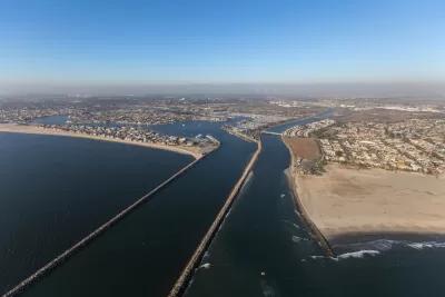
The True Scale of Flood Hazard Facing Los Angeles
New research sheds light on how L.A.’s aging and poorly maintained infrastructure is putting hundreds of thousands more residents in flood hazard zones than previously estimated.
FEMA Rule Calls for Updated Flood Modeling
Agency-funded projects will be required to be elevated at least 2 feet above the projected local flood level.

3D Modeling Aids in Predicting Hurricane Damage
Texas researchers are testing the tool in Galveston, where Hurricane Ike caused billions in damage in 2008.

Maui's Vacation Rental Debate Turns Ugly
Verbal attacks, misinformation campaigns and fistfights plague a high-stakes debate to convert thousands of vacation rentals into long-term housing.

Planetizen Federal Action Tracker
A weekly monitor of how Trump’s orders and actions are impacting planners and planning in America.

In Urban Planning, AI Prompting Could be the New Design Thinking
Creativity has long been key to great urban design. What if we see AI as our new creative partner?

King County Supportive Housing Program Offers Hope for Unhoused Residents
The county is taking a ‘Housing First’ approach that prioritizes getting people into housing, then offering wraparound supportive services.

Researchers Use AI to Get Clearer Picture of US Housing
Analysts are using artificial intelligence to supercharge their research by allowing them to comb through data faster. Though these AI tools can be error prone, they save time and housing researchers are optimistic about the future.

Making Shared Micromobility More Inclusive
Cities and shared mobility system operators can do more to include people with disabilities in planning and operations, per a new report.
Urban Design for Planners 1: Software Tools
This six-course series explores essential urban design concepts using open source software and equips planners with the tools they need to participate fully in the urban design process.
Planning for Universal Design
Learn the tools for implementing Universal Design in planning regulations.
planning NEXT
Appalachian Highlands Housing Partners
Mpact (founded as Rail~Volution)
City of Camden Redevelopment Agency
City of Astoria
City of Portland
City of Laramie