


The Port of San Diego is engaging the public to gather additional feedback on the latest draft design for the National City Bayfront’s Pepper Park.
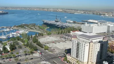
Named after prominent National City businessman and civic leader Leonard Pepper, the five-acre Pepper Park adjoins the Sweetwater Channel and offers colorful play equipment, a boat launching ramp and a fishing pier with lighting for night fishing in San Diego Bay. The Port of San Diego, which manages the park, is seeking additional public feedback on the latest draft design for the park, including input on preferred new park amenities, such as a splash pad, child play improvements, shade structures, and other items.
As reported by Katherine M. Clements, this park project is being funded by federal stimulus funds from the American Rescue Plan Act and the State of California’s Coronavirus Fiscal Recovery Fund. The Port has designated $3.85 million toward redesigning Pepper Park and constructing some park improvements. An additional $250,000 from Austal USA, a new shipbuilding facility on the National City Bayfront, has increased the project budget to about $4.1 million. The park’s existing five-acre footprint will have improvements made to the project’s first phase. Future phases are expected and would include a 2.5-acre expansion of the park. Construction of the initial priority park improvements is anticipated to begin in the Fall of 2023.
FULL STORY: Port of San Diego Asks Public to Take Pepper Park Design Survey

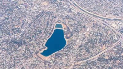
First Look: Silver Lake Reservoir Master Plan Adopted in L.A.
The Los Angeles City Council approved environmental review documents for the long-awaited Silver Lake Reservoir Master Plan, clearing the way to remake a defunct reservoir into active green and park space.
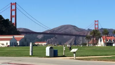
S.F. Park Will Provide Panoramic Views of the Bay
In the northwest part of San Francisco, a new park will link the Presidio to the popular Crissy Field.

Trends in Community Park Landscape Design and Planning
Urban park planning and design needs to deliver a lot of community benefit from a small amount of space. The lessons that emerge

Planetizen Federal Action Tracker
A weekly monitor of how Trump’s orders and actions are impacting planners and planning in America.

Maui's Vacation Rental Debate Turns Ugly
Verbal attacks, misinformation campaigns and fistfights plague a high-stakes debate to convert thousands of vacation rentals into long-term housing.

Restaurant Patios Were a Pandemic Win — Why Were They so Hard to Keep?
Social distancing requirements and changes in travel patterns prompted cities to pilot new uses for street and sidewalk space. Then it got complicated.

Charlottesville Temporarily Has No Zoning Code
A judge ordered the Virginia city to throw out its newly revised zoning code, leaving permitting for new development in legal limbo.

In California Battle of Housing vs. Environment, Housing Just Won
A new state law significantly limits the power of CEQA, an environmental review law that served as a powerful tool for blocking new development.

Boulder Eliminates Parking Minimums Citywide
Officials estimate the cost of building a single underground parking space at up to $100,000.
Urban Design for Planners 1: Software Tools
This six-course series explores essential urban design concepts using open source software and equips planners with the tools they need to participate fully in the urban design process.
Planning for Universal Design
Learn the tools for implementing Universal Design in planning regulations.
Heyer Gruel & Associates PA
JM Goldson LLC
Custer County Colorado
City of Camden Redevelopment Agency
City of Astoria
Transportation Research & Education Center (TREC) at Portland State University
Jefferson Parish Government
Camden Redevelopment Agency
City of Claremont