


Digital mapping tools like Google Street View often obscure the realities of cities and concentrate their resources in the wealthiest countries, effectively ‘erasing’ some places from the global map.
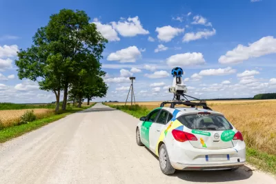
Writing in ArchDaily, Matthew Maganga highlights the failures of modern mapping tools such as Google Street View, which can literally leave some places off the map and perpetuate unequal systems of power. “Historically, far before the realm of today’s digital technologies, mapping has functioned as a method of control. This control seeped out into how unmapped spaces were viewed, as European colonial powers termed unmapped land as terra nullius and sought to, through mapping, further their imperial commercial interests.”
Today, “In a ‘post-colonial’ twenty-first-century, neo-colonialism means that some of these unmapped cities are greatly reliant on a tourism industry that seeks to attract travelers mainly from the countries of the Global North.” According to Maganga, “In Africa, only 13 countries have been mapped by Google Street View. Almost all of Central America has yet to be mapped. Much of Asia and the Middle East is similarly unavailable on Google Street View.”
In other situations, Google Street View only shows the “sanitized” parts of a city, writes Maganga. In some places, Google Street View omits informal settlements. “This form of urban cartography essentially ignores those who live in examples of less ‘formal’ architecture, exacerbating what can only be termed as an urban digital divide where places not visible on platforms such as Google Street View are in turn then forgotten by governments and political powers.”
Maganga cautions that it’s crucial to remember that “Mapping has always been biased – it’s far from a neutral endeavor.” Planners and cartographers must remember that their tools, if not deployed with care, can reinforce systems of injustice.
FULL STORY: Invisible Landscapes: When Digital Tools Fail to Document


Top Websites for Urban Planning - 2022
Every year, Planetizen collects the websites breaking new digital ground in the world of planning and related fields.
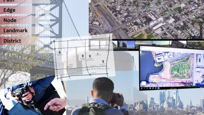
Analyzing Lynch's City Imageability in the Digital Age
Mahbubur Meenar of Rowan University writes about a recent article he co-authored in the Journal of Planning Education and Research
Will the Reconnecting Communities Program Survive Trump?
A freeway cap in Portland, Oregon is in jeopardy. But the visionary “restorative redevelopment” next door goes on.

Maui's Vacation Rental Debate Turns Ugly
Verbal attacks, misinformation campaigns and fistfights plague a high-stakes debate to convert thousands of vacation rentals into long-term housing.

Planetizen Federal Action Tracker
A weekly monitor of how Trump’s orders and actions are impacting planners and planning in America.

In Urban Planning, AI Prompting Could be the New Design Thinking
Creativity has long been key to great urban design. What if we see AI as our new creative partner?

King County Supportive Housing Program Offers Hope for Unhoused Residents
The county is taking a ‘Housing First’ approach that prioritizes getting people into housing, then offering wraparound supportive services.

Researchers Use AI to Get Clearer Picture of US Housing
Analysts are using artificial intelligence to supercharge their research by allowing them to comb through data faster. Though these AI tools can be error prone, they save time and housing researchers are optimistic about the future.

Making Shared Micromobility More Inclusive
Cities and shared mobility system operators can do more to include people with disabilities in planning and operations, per a new report.
Urban Design for Planners 1: Software Tools
This six-course series explores essential urban design concepts using open source software and equips planners with the tools they need to participate fully in the urban design process.
Planning for Universal Design
Learn the tools for implementing Universal Design in planning regulations.
planning NEXT
Appalachian Highlands Housing Partners
Gallatin County Department of Planning & Community Development
Mpact (founded as Rail~Volution)
City of Camden Redevelopment Agency
City of Astoria
City of Portland
City of Laramie