


A multi-agency effort will assess options for ‘reimagining’ the notorious Cross Bronx Expressway and improving public health and quality of life along the corridor.
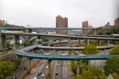
New York City’s “hated” Cross Bronx Expressway moves 200,000 vehicles per day through the borough, damaging the air quality in surrounding neighborhoods, writes Dave Colon in Streetsblog NYC. “The COVID-19 pandemic made the situation even more urgent, since the air pollution from traffic on the highway had already inflicted massive respiratory damage to residents of neighborhoods surrounding the highway, and those residents were then much more likely to have died of coronavirus as the pandemic raged through the city.”
Now, Colon writes, “The city Department of Transportation has announced a big-time multi-agency effort to ‘re-imagine’ the Cross Bronx Expressway, with the help of the state Department of Transportation, the city Planning Department and (wait for it) the city Department of Health and Mental Hygiene.”
While Colon expresses little confidence that the freeway could be eliminated altogether, a freeway cap and park is one possible alternative that could be funded through federal infrastructure funds aimed at repairing the damage caused by freeway construction. “Although the engagement and outreach on the study won’t begin until later this year, the city’s listed goals of creating new public open space and improving the quality of life along the highway corridor suggest that some form of capping the highway could be on the table.”
FULL STORY: DOT Announces Multi-Agency Study to ‘Reimagine’ the Cross Bronx Expressway

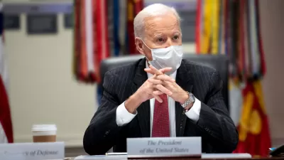
More Details of the $1.2 Trillion Federal Infrastructure Bill
There's plenty of room for analysis and discussion in a $1.2 trillion bill, so Planetizen's coverage of the historic bill continues.

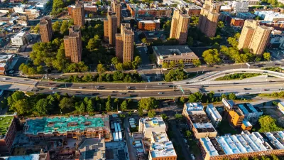
NYDOT Planning Further Cross Bronx Highway Expansion
Previously unreleased plans reveal a ‘greenwashed’ plan to expand the roadway with minimal commitment to connectivity and multimodal infrastructure.
MTA Proposes Pollution Mitigation Spending for the Bronx
Acknowledging the impact the city’s proposed congestion pricing program could have on underserved neighborhoods, the agency plans to spend over $130 million in revenue from the program on air filtration, trees, and other pollution reduction measures.

Planetizen Federal Action Tracker
A weekly monitor of how Trump’s orders and actions are impacting planners and planning in America.

Maui's Vacation Rental Debate Turns Ugly
Verbal attacks, misinformation campaigns and fistfights plague a high-stakes debate to convert thousands of vacation rentals into long-term housing.

San Francisco Suspends Traffic Calming Amidst Record Deaths
Citing “a challenging fiscal landscape,” the city will cease the program on the heels of 42 traffic deaths, including 24 pedestrians.

Amtrak Rolls Out New Orleans to Alabama “Mardi Gras” Train
The new service will operate morning and evening departures between Mobile and New Orleans.

The Subversive Car-Free Guide to Trump's Great American Road Trip
Car-free ways to access Chicagoland’s best tourist attractions.

San Antonio and Austin are Fusing Into one Massive Megaregion
The region spanning the two central Texas cities is growing fast, posing challenges for local infrastructure and water supplies.
Urban Design for Planners 1: Software Tools
This six-course series explores essential urban design concepts using open source software and equips planners with the tools they need to participate fully in the urban design process.
Planning for Universal Design
Learn the tools for implementing Universal Design in planning regulations.
Heyer Gruel & Associates PA
JM Goldson LLC
Custer County Colorado
City of Camden Redevelopment Agency
City of Astoria
Transportation Research & Education Center (TREC) at Portland State University
Jefferson Parish Government
Camden Redevelopment Agency
City of Claremont