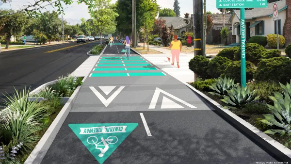
Reducing car dependency can improve air quality, increase access to jobs and opportunities, and help cities meet emissions reduction goals.

Like other cities around the country, Eugene, Oregon is "pushing several initiatives to promote '20-minute living,' the ability to reach important destinations like grocery stores and workplaces within that time frame." As reported by Haisten Willis in the Washington Post, city leaders want to make 90% of Eugene "20-minute friendly" by 2030, a goal that supporters say will improve air quality and resident health, raise property values, and reduce transportation costs.
Terri Harding, Eugene's principal planner for long-range planning, calls compact development and 20-minute neighborhoods the "pillars of growth management" for the city. The city's downtown, as a cultural and civic hub, is already a "gold-star 20-minute neighborhood," but "enhancing walkability farther out will be challenging."
Improving access isn't just about promoting biking and walking and enhancing transit. "Making cities more walkable involves creating a more compact footprint, where more businesses are built near existing homes. But it also means building housing near existing businesses, such as stores and restaurants." As deeply intertwined issues, transportation and land use must be approached simultaneously. "While the term '20-minute neighborhood' seems to refer primarily to transportation, it also speaks to land use. Planning and zoning are major factors as well, with more mixed-use and infill development needed to realize the vision."
FULL STORY: See you in 20 (or less): Living where access is within a short walk or bike ride

Planetizen Federal Action Tracker
A weekly monitor of how Trump’s orders and actions are impacting planners and planning in America.

In Praise of Analog Cities: Futureproofing in a Time of Crisis
I didn’t need a pandemic or a war to teach me that smart cities weren’t the future — but it sure drove the message home.

Silicon Valley ‘Bike Superhighway’ Awarded $14M State Grant
A Caltrans grant brings the 10-mile Central Bikeway project connecting Santa Clara and East San Jose closer to fruition.

The Osage Nation’s Effort to Clean Up Abandoned Oil Wells
The Osage Nation is leading a complex and long-term initiative to identify, plug, and remediate thousands of orphaned oil wells on its reservation, protecting land, water, and community health for future generations.

Knoxville Ranked Best US City for People With Disabilities
An analysis of accessibility, affordability, healthcare access, and other metrics reveals the most disability-friendly U.S. cities.

FTA Allows Changes to Low or No Emission Grant Proposals
Grant recipients can change their proposals from zero-emission to low-emission projects, a move the FTA says will offer more flexibility to cities and transit providers.
Urban Design for Planners 1: Software Tools
This six-course series explores essential urban design concepts using open source software and equips planners with the tools they need to participate fully in the urban design process.
Planning for Universal Design
Learn the tools for implementing Universal Design in planning regulations.
Heyer Gruel & Associates PA
Yukon Government
New Jersey Institute of Technology
Mpact (founded as Rail~Volution)
City of Camden Redevelopment Agency
City of Norman, Oklahoma
City of Portland
City of Laramie


