


A new methodology can help cities assess the impact of new developments on walkers.
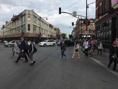
While planners frequently use forecasting models to predict the impact of new developments on traffic, congestion, and road quality, no such model existed for assessing the effects of development on non-drivers. Now, reports Kea Wilson for Streetsblog, "Massachusetts Institute of Technology Researcher Andres Sevstuk has created a sophisticated new methodology for estimating changes in the volume of walkers on city streets at different times throughout the day in response to changes in the built environment, in much the same way that planners estimate how vehicle traffic will change after they break ground on a building or roadway redesign."
Similar traffic impact assessments (TIAs) are frequently used to evaluate the impact of projects. According to researcher Andres Sevstuk, "if the TIA forecast that a project would put more traffic onto city streets than the current road design can tolerate, then the developer typically has to pay to address that — maybe by building extra parking, or paying to widen a road, or paying to adjust traffic signal timing." Sevstuk argues that adding more infrastructure for counting pedestrians could have a "dramatic effect" on our understanding of how land use affects walking in cities.
Sevstuk's model, writes Wilson, "would be re-calibrated by each community using at least some local walking data, but even without those inputs, it can predict pedestrian volumes with roughly 70 to 80 percent accuracy." This information can help cities decide where to build amenities like parks or parking lots and serve as "a critical tool to identify where to prioritize pedestrian improvements that planners haven’t even considered yet." Further, "[o]verlaying projections with actual pedestrian crash data and data on corridors that have been historically disinvested could be even more helpful as leaders work towards ending traffic violence and making cities more equitable."
FULL STORY: New Traffic Model Predicts How New Developments Will Affect Walkers


'The World's Most Beautiful Avenue' Getting A Green Makeover
Paris Mayor Anne Hidalgo approved a new plan to revitalize the Champs Élysées ahead of the 2024 Summer Olympics.

Chicago Judge Orders Thousands of Accessible Ped Signals
Only 3% of the city's crossing signals are currently accessible to blind pedestrians.
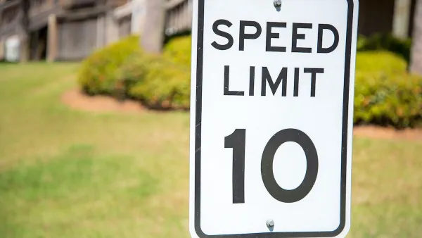
Washington Passes First US ‘Shared Streets’ Law
Cities will be allowed to lower speed limits to 10 miles per hour and prioritize pedestrians on certain streets.

Maui's Vacation Rental Debate Turns Ugly
Verbal attacks, misinformation campaigns and fistfights plague a high-stakes debate to convert thousands of vacation rentals into long-term housing.

Planetizen Federal Action Tracker
A weekly monitor of how Trump’s orders and actions are impacting planners and planning in America.

San Francisco Suspends Traffic Calming Amidst Record Deaths
Citing “a challenging fiscal landscape,” the city will cease the program on the heels of 42 traffic deaths, including 24 pedestrians.

Defunct Pittsburgh Power Plant to Become Residential Tower
A decommissioned steam heat plant will be redeveloped into almost 100 affordable housing units.

Trump Prompts Restructuring of Transportation Research Board in “Unprecedented Overreach”
The TRB has eliminated more than half of its committees including those focused on climate, equity, and cities.

Amtrak Rolls Out New Orleans to Alabama “Mardi Gras” Train
The new service will operate morning and evening departures between Mobile and New Orleans.
Urban Design for Planners 1: Software Tools
This six-course series explores essential urban design concepts using open source software and equips planners with the tools they need to participate fully in the urban design process.
Planning for Universal Design
Learn the tools for implementing Universal Design in planning regulations.
Heyer Gruel & Associates PA
JM Goldson LLC
Custer County Colorado
City of Camden Redevelopment Agency
City of Astoria
Transportation Research & Education Center (TREC) at Portland State University
Jefferson Parish Government
Camden Redevelopment Agency
City of Claremont