


Arizona will lose one-fifth of its water allotment from the Colorado River in 2022 as cuts from the river's Drought Contingency Plan take effect.
Ian James writes about how Arizona water officials are preparing to subsist on far less water than hoped in the coming years, as the megadrought along the Colorado River deepens and the relatively new Drought Contingency Plan (DCP) takes effect, determining how much water will be allotted to the seven states along the Colorado River watershed during lean water years.
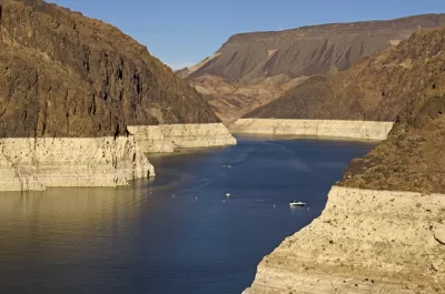
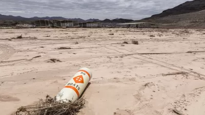
"Lake Mead’s decline is expected to trigger substantial reductions in water deliveries in 2022 for Arizona, Nevada and Mexico. The largest of those cuts will affect Arizona, slashing its Colorado River supplies by 512,000 acre-feet, about a fifth of its total entitlement," explains James.
"While that will shrink the amount of water flowing to farmlands through the Central Arizona Project Canal, the state’s water managers said during Thursday’s meeting that they’re prepared and have plans ready to handle shortages over the next five years, even if Lake Mead continues to drop to levels that would bring larger cutbacks."
Ted Cooke, general manager of the Central Arizona Project (CAP), is quoted in the article saying that the DCP was crafted with the assumption that drastic conservation measures would eventually be necessary.
According to James, the state of Arizona's response will involve pumping extra groundwater for farmland in Pinal County, where cotton, hay, and other crops grow.
"Farmers in Pinal County hold the lowest priority for water from the CAP. Under a shortage, they’re in line to lose all that water. But the state’s plan will provide them with 'mitigation' water in 2022 that will amount to about a third of their previous supply," explains James.
This big feature story includes a lot more detail about the broader environmental context of the Colorado River watershed, as well as the consequences of the DCP for other states that rely on the river, like Nevada and California.
FULL STORY: Facing a Colorado River shortage, Arizona prepares for the pain of water cutbacks

Op-Ed: Implications for Phoenix as Lake Mead Runs Dry
Metro Phoenix has a lot to think about as Lake Mead water shortages become ever more likely. A three-state drought contingency plan may only be a temporary fix for a problem that'll divide cities and stakeholders.
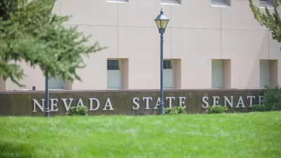
Nevada Bans the Use of Colorado River Water for Ornamental Grass
AB 356 could be "the most aggressive municipal water conservation measure that's been taken in the western United States."
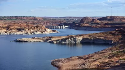
New Drought Contingencies Triggered for Upper Colorado River States
The latest Bureau of Reclamation report on water levels in Lake Powell and Lake Mead trigger new drought contingencies in Colorado, New Mexico, Utah, and Wyoming.

Rethinking Redlining
For decades we have blamed 100-year-old maps for the patterns of spatial racial inequity that persist in American cities today. An esteemed researcher says: we’ve got it all wrong.

Planetizen Federal Action Tracker
A weekly monitor of how Trump’s orders and actions are impacting planners and planning in America.

Walmart Announces Nationwide EV Charging Network
The company plans to install electric car chargers at most of its stores by 2030.

Seattle’s Pike Place Market Leans Into Pedestrian Infrastructure
After decades of debate, the market is testing a car ban in one of its busiest areas and adding walking links to the surrounding neighborhood.

The World’s Longest Light Rail Line is in… Los Angeles?
In a city not known for its public transit, the 48.5-mile A Line is the longest of its kind on the planet.

Quantifying Social Infrastructure
New developments have clear rules for ensuring surrounding roads, water, and sewers can handle new users. Why not do the same for community amenities?
Urban Design for Planners 1: Software Tools
This six-course series explores essential urban design concepts using open source software and equips planners with the tools they need to participate fully in the urban design process.
Planning for Universal Design
Learn the tools for implementing Universal Design in planning regulations.
City of Moorpark
City of Tustin
City of Camden Redevelopment Agency
City of Astoria
Transportation Research & Education Center (TREC) at Portland State University
Regional Transportation Commission of Southern Nevada
Toledo-Lucas County Plan Commissions