


The city wants to cut its car use in half by 2030 as part of an aggressive set of "aspirational" goals.
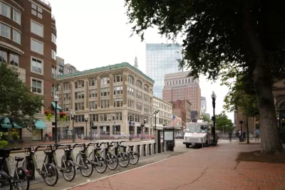
Boston's Department of Transportation is moving forward with its Connect Downtown bikeway project with new protected bike lanes which, the city hopes, will make bicycle travel "more comfortable and more possible" for Bostonians, according to the city's Chief of Streets Chris Osgood.
As part of the city's goals to combat climate change and improve transportation equity through its GoBoston 2030initiative, Boston hopes to cut citywide traffic by 50% in the next decade in part by promoting bicycling as a viable mode of transit. Other goals include expanded access to transit and safer and more reliable service, all actions that could not only boost transit ridership but vastly improve service for existing transit users.
The new bikeways connect downtown offices with existing routes to residential neighborhoods using painted lanes and flexible delineators. Streetsblog Mass offers a photo tour of the new infrastructure.
FULL STORY: Eyes On the Street: Boston’s New Downtown Protected Bike Lanes

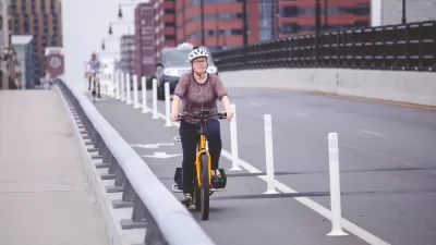
Boston Launches Ambitious Bike Plan
The city plans to dramatically expand its bike lane network, add to its bike share fleet, and provide new e-bike subsidies to residents.
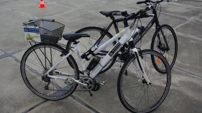
The E-Bike Boom Continues
The popularity of electric bikes doesn't seem to be waning as the devices outpace electric car sales by almost two to one.
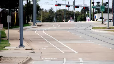
Dallas Makes First-Ever Annual Commitment to its Bike Lane Program
Dallas is making new commitments to alternative transportation options—the latest example is found in a budget expenditure for several bike lane projects.

Montreal Mall to Become 6,000 Housing Units
Place Versailles will be transformed into a mixed-use complex over the next 25 years.

Planetizen Federal Action Tracker
A weekly monitor of how Trump’s orders and actions are impacting planners and planning in America.

Four Reasons Urban Planners Can’t Ignore AI
It’s no longer a question of whether AI will shape planning, but how. That how is up to us.

Bend, Deschutes County Move to Restrict Major Homeless Encampment
City and county officials are closing off portions of an area known as Juniper Ridge where many unhoused residents find shelter, hoping to direct people to housing and supportive services.

High Housing Costs Driving Down Transit Ridership in LA
When neighborhoods gentrify and displace lower-income residents, transit ridership suffers, new research shows.

Iowa Legalizes Accessory Dwelling Units
A new law will allow property owners to build ADUs on single-family lots starting on July 1.
Urban Design for Planners 1: Software Tools
This six-course series explores essential urban design concepts using open source software and equips planners with the tools they need to participate fully in the urban design process.
Planning for Universal Design
Learn the tools for implementing Universal Design in planning regulations.
City of Mt Shasta
City of Camden Redevelopment Agency
City of Astoria
Transportation Research & Education Center (TREC) at Portland State University
City of Camden Redevelopment Agency
Municipality of Princeton (NJ)
Regional Transportation Commission of Southern Nevada