


A case study from the Boston region shows the power of allowing moderate density on transit adjacent residential parcels currently available only to single-family detached homes.
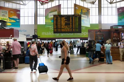
"[H]igh housing costs and inadequate supply are not a natural outcome of market forces; they are the result of policy choices," according to an article by Sarah Crump, Trevor Mattos, Jenny Schuetz, and Luc Schuster.
The consequences of policy choices are a disconnect between land values and land uses in the Boston region.
Land is very expensive, but the housing is mostly low-density: single-family detached homes with large yards. The Massachusetts Housing Partnership’s TODEX dataset shows that the median housing density near commuter rail stations is 2.8 homes per acre—equivalent to single-family homes on one-third acre lots. This isn’t a market outcome—it’s a sign that zoning is preventing housing markets from working.
This team of writers is presenting a new report that offers a prescription for the rising cost of housing, and resulting social ills, in Boston: loosening zoning restrictions to allow moderate-density housing near transit stations in the region, thus bringing policy and the market in closer alignment.
To allow for more housing to be built in high-demand locations, the state of Massachusetts should adopt a policy that allows moderate-density housing to be built as-of-right within a half mile of transit stations. Moderate-density housing includes duplexes, attached townhouses, and low- to mid-rise multifamily buildings.
To exemplify the affect of such a hypothetical approach to land use regulation in the state of Massachusetts, the article and the report imagines the effect of such policies on land near four commuter rail stations: Beverly Farms, Melrose Cedar Park, Needham Heights, and Wellesley Hills. The results of the experiment show decreasing home prices, and a essential first step toward solving the region's affordability problems.
FULL STORY: Fixing Greater Boston’s housing crisis starts with legalizing apartments near transit


Birthplace of Single-Family Zoning Poised to Pass Upzoning Plan
Berkeley, California, pioneered exclusionary zoning in the early 1900s; with its new upzoning proposal, the city hopes to reverse that negative legacy and boost its housing supply by eliminating single-family zoning.
Survey: Seattle-Area Residents Support Upzoning
To fight the growing housing crisis, most King County residents support an end to single-family zoning and accelerated housing development, according to a new poll.

Boston Zoning Commission to Consider ‘Squares and Streets’ Plan
The proposal would reduce barriers to the development of denser housing.

Planetizen Federal Action Tracker
A weekly monitor of how Trump’s orders and actions are impacting planners and planning in America.

Maui's Vacation Rental Debate Turns Ugly
Verbal attacks, misinformation campaigns and fistfights plague a high-stakes debate to convert thousands of vacation rentals into long-term housing.

San Francisco Suspends Traffic Calming Amidst Record Deaths
Citing “a challenging fiscal landscape,” the city will cease the program on the heels of 42 traffic deaths, including 24 pedestrians.

Amtrak Rolls Out New Orleans to Alabama “Mardi Gras” Train
The new service will operate morning and evening departures between Mobile and New Orleans.

The Subversive Car-Free Guide to Trump's Great American Road Trip
Car-free ways to access Chicagoland’s best tourist attractions.

San Antonio and Austin are Fusing Into one Massive Megaregion
The region spanning the two central Texas cities is growing fast, posing challenges for local infrastructure and water supplies.
Urban Design for Planners 1: Software Tools
This six-course series explores essential urban design concepts using open source software and equips planners with the tools they need to participate fully in the urban design process.
Planning for Universal Design
Learn the tools for implementing Universal Design in planning regulations.
Heyer Gruel & Associates PA
JM Goldson LLC
Custer County Colorado
City of Camden Redevelopment Agency
City of Astoria
Transportation Research & Education Center (TREC) at Portland State University
Jefferson Parish Government
Camden Redevelopment Agency
City of Claremont