


Data collected from 13 million tree planting records in 473 urban areas across 73 countries provides insight into the role of urban trees in biodiversity conservation.
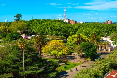
Alessandro Ossola, lead author of a new study tracking plant diversity among urban trees, says that the study of trees in cities is a missed opportunity for those making efforts to conserve biodiversity.
"To understand which trees are planted in cities around the world, and the climates and natural habitats they face, his team conducted an ambitious inventory as part of their Which Plant Where project. They discovered a wealth of data on trees in cities and towns, systematically mining nearly 13 million tree planting records from 2010," writes Natalie Parletta.
Ossola's team reported on the conservation status and potential of a given tree to become an invasive species with help from the International Union for Conservation of Nature (IUCN) and the Global Register of Introduced and Invasive Species (GRIIS). The research is the most comprehensive catalog of trees to date with data from 473 urban areas across 73 countries.
We can expect some tree species might be lost in the future due to high temperatures and a lack of rainfall, says Parletta. "Results suggest other tree species could thrive, even under future climates. The researchers note the database could help inform appropriate species selection and avoid potential invaders in efforts to green cities and conserve biodiversity" writes Parletta reassuringly.
FULL STORY: The importance of urban trees


‘Smart Surfaces’ Policy Guide Offers Advice for Building and Maintaining Urban Tree Canopies
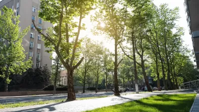
Healthy, robust tree canopies can reduce the impacts of extreme heat and improve air quality.
The Economic Value of Street Trees
Far from just providing shade and improving air quality, trees can also contribute to more resilient roads, lower energy costs, and reduced flood risk.

LA County Releases Draft Community Forest Management Plan
LA County's Chief Sustainability Office just released the discussion draft of Room to Grow, the first Community Forest Management Plan for the county.

Planetizen Federal Action Tracker
A weekly monitor of how Trump’s orders and actions are impacting planners and planning in America.

Congressman Proposes Bill to Rename DC Metro “Trump Train”
The Make Autorail Great Again Act would withhold federal funding to the system until the Washington Metropolitan Area Transit Authority (WMATA), rebrands as the Washington Metropolitan Authority for Greater Access (WMAGA).

DARTSpace Platform Streamlines Dallas TOD Application Process
The Dallas transit agency hopes a shorter permitting timeline will boost transit-oriented development around rail stations.

San Francisco's School District Spent $105M To Build Affordable Housing for Teachers — And That's Just the Beginning
SFUSD joins a growing list of school districts using their land holdings to address housing affordability challenges faced by their own employees.

Car-Centric LA Suburb Looks to a Train-Oriented Future
City leaders in Rancho Cucamonga, the future western terminus of the Brightline West rail line to Las Vegas, want to reimagine the city as a transit-oriented, pedestrian-friendly community.

New Alaska Bitcoin Mine Would Burn as Much Energy as the State’s Largest Coal Plant
Fueled by “stranded” natural gas, the startup hopes to become the largest in the US, and to make Alaska an industry center.
Urban Design for Planners 1: Software Tools
This six-course series explores essential urban design concepts using open source software and equips planners with the tools they need to participate fully in the urban design process.
Planning for Universal Design
Learn the tools for implementing Universal Design in planning regulations.
Municipality of Princeton
Roanoke Valley-Alleghany Regional Commission
City of Mt Shasta
City of Camden Redevelopment Agency
City of Astoria
Transportation Research & Education Center (TREC) at Portland State University
US High Speed Rail Association
City of Camden Redevelopment Agency
Municipality of Princeton (NJ)