


Data-Smart City Solutions at the Harvard Kennedy School is monitoring the use of GIS technology to inform the public health response to the coronavirus pandemic.

Mathew Leger gathers a list of some of the new innovative mapping solutions created by the GIS community across the world to support local responses to the coronavirus pandemic.
Pulling from International examples, Leger includes projects that measure park capacity in Singapore, self-reported health symptoms in Switzerland, hospital wait times in Northern Ireland, and more.
The latest post by Leger is the third in an ongoing series of similarly themed collections. The first and second posts highlighted both U.S.-based best practices and a couple of international examples.
FULL STORY: COVID-19 Response: GIS Best Practices from Across the Globe


Esri Sets Up COVID-19 GIS Hub
The planning profession can contribute to the worldwide fight to control the spread of COVID-19. GIS technology, for instance, allows real-time monitoring of the pandemic.
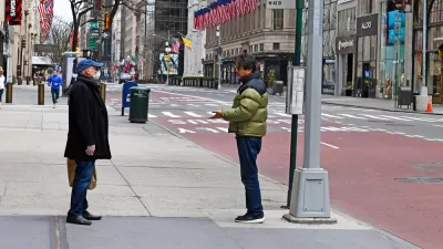
Friday Eye Candy: Covid-19, Then and Now
The New York Times compared images from readers portraying similar scenes in 2020 and 2022.
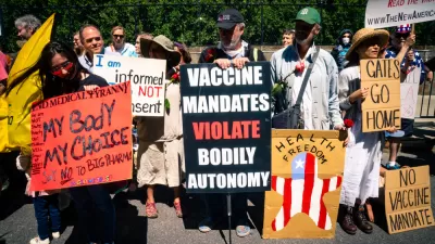
The Shifting Demographics of Covid-19
For most of the Covid-19 pandemic, Black Americans died at much higher rates than White Americans. That trend has reversed at times during the past year.

Montreal Mall to Become 6,000 Housing Units
Place Versailles will be transformed into a mixed-use complex over the next 25 years.

Planetizen Federal Action Tracker
A weekly monitor of how Trump’s orders and actions are impacting planners and planning in America.

DARTSpace Platform Streamlines Dallas TOD Application Process
The Dallas transit agency hopes a shorter permitting timeline will boost transit-oriented development around rail stations.

Study: 4% of Truckers Lack a Valid Commercial License
Over 56% of inspected trucks had other violations.

Chicago Judge Orders Thousands of Accessible Ped Signals
Only 3% of the city's crossing signals are currently accessible to blind pedestrians.

Philadelphia Swaps Car Lanes for Bikeways in Unanimous Vote
The project will transform one of the handful of streets responsible for 80% of the city’s major crashes.
Urban Design for Planners 1: Software Tools
This six-course series explores essential urban design concepts using open source software and equips planners with the tools they need to participate fully in the urban design process.
Planning for Universal Design
Learn the tools for implementing Universal Design in planning regulations.
City of Mt Shasta
City of Camden Redevelopment Agency
City of Astoria
Transportation Research & Education Center (TREC) at Portland State University
US High Speed Rail Association
City of Camden Redevelopment Agency
Municipality of Princeton (NJ)