


Under the transit tab on Google Maps, users will now be able to incorporate trips that start on a bike but end on a bus, train, or other mode of transport.

Google now offers multi-modal directions on some platforms. Travelers can use their phones not only to look up transit, walking, car, or biking directions, but now they can also use the service to get directions that incorporate multiple modes. This new feature is meant to help give information relevant to each leg of a multimodal journey including information about how crowded trains are, what traffic is like, and how long one would be likely to wait for a train.
"Transit directions paired with ride-sharing and biking will start rolling today out on iOS. Android users will also get transit plus ride-sharing starting today, but they will have to wait a little longer for transit plus biking," Andrew J. Hawkins reports for the Verge.
FULL STORY: Google Maps will now let users combine transit directions with biking and ride-sharing

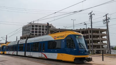
Two Years In, a Look at the Twin Cities Fare Discount Program
In 2017, Metro Transit in the Twin Cities raised fares but also started a program for low-income riders to help ease the burden of travel costs.
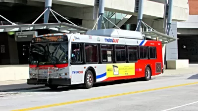
D.C.-Area Residents Want Bus Lanes and Free Transfers, Survey Shows
New survey findings identify transit priorities among residents in D.C. and surrounding areas, and indicate broad support for public investments.

Google's New 'Visual Position System' Takes Pedestrian Navigation to the Next Level
In case you've ever felt like Google Maps isn't as helpful on foot as it is in a car, there's a new technology just for you.

Maui's Vacation Rental Debate Turns Ugly
Verbal attacks, misinformation campaigns and fistfights plague a high-stakes debate to convert thousands of vacation rentals into long-term housing.

Planetizen Federal Action Tracker
A weekly monitor of how Trump’s orders and actions are impacting planners and planning in America.

In Urban Planning, AI Prompting Could be the New Design Thinking
Creativity has long been key to great urban design. What if we see AI as our new creative partner?

Making Shared Micromobility More Inclusive
Cities and shared mobility system operators can do more to include people with disabilities in planning and operations, per a new report.

Car Designs Make it Harder to See Pedestrians
Blind spots created by thicker pillars built to withstand rollover crashes are creating dangerous conditions for people outside vehicles.

Cal Fire Chatbot Fails to Answer Basic Questions
An AI chatbot designed to provide information about wildfires can’t answer questions about evacuation orders, among other problems.
Urban Design for Planners 1: Software Tools
This six-course series explores essential urban design concepts using open source software and equips planners with the tools they need to participate fully in the urban design process.
Planning for Universal Design
Learn the tools for implementing Universal Design in planning regulations.
Appalachian Highlands Housing Partners
Gallatin County Department of Planning & Community Development
Heyer Gruel & Associates PA
Mpact (founded as Rail~Volution)
City of Camden Redevelopment Agency
City of Astoria
City of Portland
City of Laramie