


Code requirements for wind resistance vary substantially across Florida, with less stringent building requirements in areas of the Panhandle hit hard by Hurricane Michael.

In Hurricane Michael's aftermath, it's devastatingly clear that structures in the storm's path were unable to weather a Category 4 storm. Florida code requirements are the most stringent in South Florida, Andres Viglucci, David Ovalle, Caitlin Ostroff, and Nicholas Nehamas report. However, "they taper down the farther north you move along the peninsula. In most of the Panhandle, the code requirements are significantly less stringent."
For instance, structures in Miami-Date County must be able to withstand winds of 175 miles an hour, while "along the stretch of the Panhandle hit hardest by Michael — including Mexico Beach, Apalachicola and Panama City — the design standard drops to as low as 120 miles an hour before rising gradually to 150 mph around Pensacola at the state's far western edge."
FULL STORY: Florida’s building code is tough, but Michael was tougher. Is it time for a rewrite?

Florida Prepares for Irma: Building Codes, Cranes, Evacuation, Storm Surge
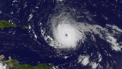
As Irma leaves the Caribbean and heads for Florida, with landfall expected this weekend, there is a lot to worry about: New building codes will be put to test, fuel to evacuate is in short supply, and cranes have not been dismantled.
When Coastal States Kill Building Codes, FEMA Pays
Despite the increasing number and intensity of natural disasters, some vulnerable states are relaxing building regulations and leaving the federal government to pick up the tab when tragedy strikes again.

‘Quality Work, Fast’: NC Gears up for Homebuilding After Helene, Trying to Avoid Past Pitfalls
The state will field bids to demolish, repair and rebuild homes in the mountains. After struggles in eastern NC, officials aim to chart a different course.

Planetizen Federal Action Tracker
A weekly monitor of how Trump’s orders and actions are impacting planners and planning in America.

Congressman Proposes Bill to Rename DC Metro “Trump Train”
The Make Autorail Great Again Act would withhold federal funding to the system until the Washington Metropolitan Area Transit Authority (WMATA), rebrands as the Washington Metropolitan Authority for Greater Access (WMAGA).

DARTSpace Platform Streamlines Dallas TOD Application Process
The Dallas transit agency hopes a shorter permitting timeline will boost transit-oriented development around rail stations.

Renters Now Outnumber Homeowners in Over 200 US Suburbs
High housing costs in city centers and the new-found flexibility offered by remote work are pushing more renters to suburban areas.

The Tiny, Adorable $7,000 Car Turning Japan Onto EVs
The single seat Mibot charges from a regular plug as quickly as an iPad, and is about half the price of an average EV.

Supreme Court Ruling in Pipeline Case Guts Federal Environmental Law
The decision limits the scope of a federal law that mandates extensive environmental impact reviews of energy, infrastructure, and transportation projects.
Urban Design for Planners 1: Software Tools
This six-course series explores essential urban design concepts using open source software and equips planners with the tools they need to participate fully in the urban design process.
Planning for Universal Design
Learn the tools for implementing Universal Design in planning regulations.
Municipality of Princeton
Roanoke Valley-Alleghany Regional Commission
City of Mt Shasta
City of Camden Redevelopment Agency
City of Astoria
Transportation Research & Education Center (TREC) at Portland State University
US High Speed Rail Association
City of Camden Redevelopment Agency
Municipality of Princeton (NJ)