


According to Next City, "Euclid is doing what many Great Lakes cities thought would never be possible."
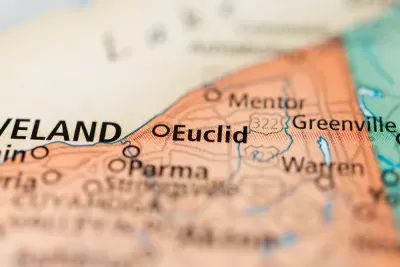
The Euclid City Council voted to build a trail on the Lake Erie waterfront that Cleveland.com calls "innovative and nationally significant."
One notable aspect of the project, according to reporter Steven Litt, is the deal the city made with neighboring property owners "to allow public access along the waterfront in their backyards in exchange for publicly financed improvements aimed at halting erosion." The city also voted to issue a $2 million bond for the trail's first phase.
The three-quarter-mile trail would begin at the fishing pier at Sims Park, with public access to the waterfront provided by stairway on a parcel owned by the city. When completed, the eastern half of the trail would lead to a proposed paddle beach.
Part of a master greenway plan for Cleveland, the lakefront project represents ambitions to raise property values in the suburban area facing "increasing poverty, loss of jobs and a shrinking tax base." It could become a model for other cities in the region, Litt suggests, pointing to previous coverage in Next City.
FULL STORY: Euclid City Council takes historic vote to launch innovative lakefront trail

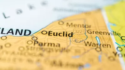
How One Lake Erie Town Got Free Waterfront Property for Public Use
Clear communication and a fair trade let Euclid, Ohio begin to rethink its lakefront—and its future.
2011 Master Plan for the Central Delaware Cut Philadelphia's Waterfront Short
Waterfront views and large parcels of vacant land should be a good urban revitalization in a growing city like Philadelphia, but the Central Delaware waterfront has fallen short of expectations.
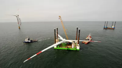
Offshore Wind Lands on Lake Erie
By 2019, a multi-million dollar project developed by a former "big energy" guy might make Cleveland the new U.S. leader in renewable energy.

Planetizen Federal Action Tracker
A weekly monitor of how Trump’s orders and actions are impacting planners and planning in America.

Congressman Proposes Bill to Rename DC Metro “Trump Train”
The Make Autorail Great Again Act would withhold federal funding to the system until the Washington Metropolitan Area Transit Authority (WMATA), rebrands as the Washington Metropolitan Authority for Greater Access (WMAGA).

DARTSpace Platform Streamlines Dallas TOD Application Process
The Dallas transit agency hopes a shorter permitting timeline will boost transit-oriented development around rail stations.

Renters Now Outnumber Homeowners in Over 200 US Suburbs
High housing costs in city centers and the new-found flexibility offered by remote work are pushing more renters to suburban areas.

The Tiny, Adorable $7,000 Car Turning Japan Onto EVs
The single seat Mibot charges from a regular plug as quickly as an iPad, and is about half the price of an average EV.

Supreme Court Ruling in Pipeline Case Guts Federal Environmental Law
The decision limits the scope of a federal law that mandates extensive environmental impact reviews of energy, infrastructure, and transportation projects.
Urban Design for Planners 1: Software Tools
This six-course series explores essential urban design concepts using open source software and equips planners with the tools they need to participate fully in the urban design process.
Planning for Universal Design
Learn the tools for implementing Universal Design in planning regulations.
Municipality of Princeton
Roanoke Valley-Alleghany Regional Commission
City of Mt Shasta
City of Camden Redevelopment Agency
City of Astoria
Transportation Research & Education Center (TREC) at Portland State University
US High Speed Rail Association
City of Camden Redevelopment Agency
Municipality of Princeton (NJ)