Analyzing reported ‘near-misses’ can reveal road safety gaps and prevent more serious crashes and injuries.


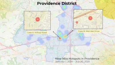
A survey conducted by Northern Virginia Families for Safe Streets analyzes where pedestrians face ‘near-misses’ with cars, indicating traffic safety hotspots that could be improved.
As Vernon Miles explains in FFX Now, “The survey said 52% of the Near Miss reports noted that children were present and cited failure to yield as a major risk.” The data comes from the Near Miss survey app, which the survey report notes likely skews data to more well-off neighborhoods, where people are more likely to use the app and report data. However, the data reveals that near misses are concentrated at particular intersections, offering valuable insight for local planners. While near-misses are not typically accounted for in traffic injury data, surveys like this can identify dangerous street segments before people get seriously injured or killed.
“The survey said the goal should be a 15% reduction in serious injuries, with measures such as more complete streets designs and speed limits lowered to less than 25 miles per hour on more residential roads.”
FULL STORY: Transportation safety advocates highlight concerns at Reston Town Center and Merrifield roads

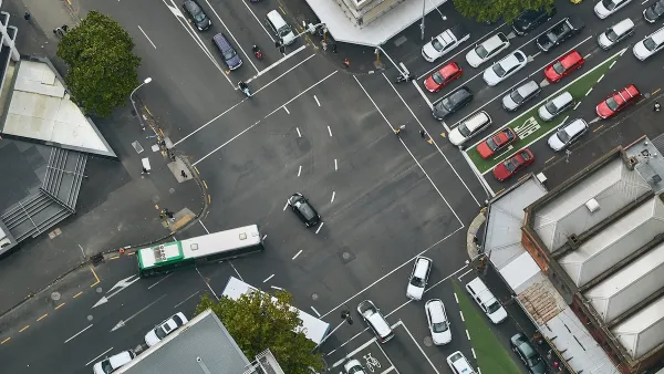
How Understanding Near-Misses Can Improve Road Safety
Most road safety efforts are based on data about crashes that have already occurred. But important information can be gleaned from incidents when something almost went wrong, but didn’t.

Pittsburgh Agencies Collaborate on Vision Zero Projects
The city reduced pedestrian deaths to seven in 2023.
Memphis is the nation's most dangerous city for pedestrians
Memphis had the highest rate of traffic deaths for people walking in the US for two years in a row.

The state-sanctioned urbicide of Austin
People don’t kill cities. Freeways do.

US to reduce Colorado River water deliveries to Mexico
A new Colorado Treaty amendment reduces Mexico’s Colorado River water allocation by 250,000 acre feet.

New Jersey’s second-largest city bans standalone data centers
Jersey City will continue to allow co-location facilities, such as those meant for research institutions that store their own data.

Amtrak not solely to blame for New Jersey commuter rail's unreliability, report finds
A new study from the Garden State Initiative found that NJ Transit’s budget grew 20% across a 4 year period, but reliability declined significantly over the same period.

EPA erases limits on planet-warming pollution from power plants
Under Monday’s plan, power plants would still have some limits on how much mercury, arsenic and other contaminants they can emit.

Phoenix announces new on-demand transit service, more frequent RAPID buses
Both new services will launch in October, and are part of Phoenix's Project Effective Access Solutions for Easing Congestion.

FREE Course: Walkable City 1: Why Walkability?
After describing his path towards focusing on walkability as the essence of good planning, Jeff Speck marches through his five principal reasons for making more walkable places.
Reinventing Malls: Planning Alchemy—Turning Gray Fields Into Gold
The course focuses on the opportunities and imperatives that shape reinvention of mall sites.

Eagle County Government
Harvard University Graduate School of Design
Nashville Planning Department
The Architects Foundation
University of Cincinnati Online
The Pocatello Development Authority
The Urban Renewal Agency of the City of Pocatello
Journal of the American Planning Association