


The online map builds a comprehensive database of fire prevention and mitigation efforts at every level of government to help agencies coordinate their work and understand the impacts of projects.
A new online dashboard from the state of California tracks wildfire prevention and mitigation work. According to a press release from Governor Gavin Newsom’s office, “For the first time, all fuels management projects are being tracked in one place, on one map, delivering valuable information for project planning and wildfire response.”
The Interagency Treatment Dashboard offers a comprehensive view of wildfire resilience efforts at multiple levels of government, while the Fuel Treatment Effectiveness Dashboard tracks how treatments have impacted fire behavior and firefighting and evacuation efforts. “In 2023, 700,000 acres were treated to help protect against wildfires, with many protected acres receiving multiple treatments such as thinning, prescribed fire, or other practices to improve forest health and community resilience.” This is a major increase from 2021 due in part to a doubling of prescribed treatments.
The dashboards are part of a broader fire resilience strategy that includes increased investments in wildfire resilience, higher staffing levels for firefighting units, an expansion of the state’s aerial firefighting fleet, and technological tools such as drones and AI that can help limit the destruction of fires and save lives.


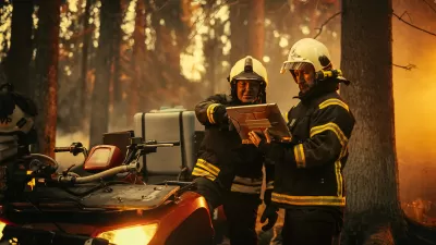
UCLA Experts Offer Critical Support for LA Wildfire Response and Recovery
The UCLA Luskin Center for Innovation offers expert guidance on LA wildfire response and recovery, addressing critical issues like water safety, air quality, equitable rebuilding, and climate adaptation to promote resilience and sustainability.
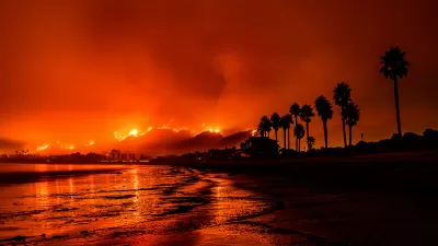
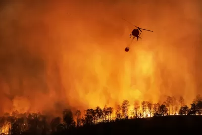
Wildfires Explode Across the West
Multiple massive fires are burning across the Western United States and Canada, prompting governments to explore new mitigation and response strategies.
California Using AI to Get Ahead of Wildfires
The state is pioneering the use of technology to identify wildfire risks and alert firefighters before blazes get out of control.

Planetizen Federal Action Tracker
A weekly monitor of how Trump’s orders and actions are impacting planners and planning in America.

Maui's Vacation Rental Debate Turns Ugly
Verbal attacks, misinformation campaigns and fistfights plague a high-stakes debate to convert thousands of vacation rentals into long-term housing.

San Francisco Suspends Traffic Calming Amidst Record Deaths
Citing “a challenging fiscal landscape,” the city will cease the program on the heels of 42 traffic deaths, including 24 pedestrians.

Amtrak Rolls Out New Orleans to Alabama “Mardi Gras” Train
The new service will operate morning and evening departures between Mobile and New Orleans.

The Subversive Car-Free Guide to Trump's Great American Road Trip
Car-free ways to access Chicagoland’s best tourist attractions.

San Antonio and Austin are Fusing Into one Massive Megaregion
The region spanning the two central Texas cities is growing fast, posing challenges for local infrastructure and water supplies.
Urban Design for Planners 1: Software Tools
This six-course series explores essential urban design concepts using open source software and equips planners with the tools they need to participate fully in the urban design process.
Planning for Universal Design
Learn the tools for implementing Universal Design in planning regulations.
Heyer Gruel & Associates PA
JM Goldson LLC
Custer County Colorado
City of Camden Redevelopment Agency
City of Astoria
Transportation Research & Education Center (TREC) at Portland State University
Jefferson Parish Government
Camden Redevelopment Agency
City of Claremont