


The new data can help communities identify risks and assess potential land use impacts in coastal areas.
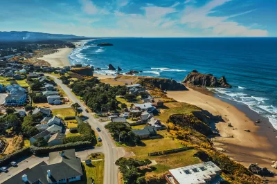
The National Oceanic and Atmospheric Administration (NOAA) announced a new land cover dataset that can help coastal communities assess their risk from sea level rise and plan for mitigation measures.
The land cover data improves on past available data with higher resolution that is 900 times more detailed than before. “Land cover data is frequently used in coastal management applications, and is the backbone of key predictive models for sea level rise and stormwater management,” explains a press release from NOAA. Local jurisdictions can use the data to assess flood risk, understand land use impacts, model future infrastructure projects, and more.
The project was funded with $8 million from the Bipartisan Infrastructure Law and private sector partnerships. According to the release, “This announcement is particularly important for Alaska, as the state has never had widespread high-resolution land cover data.”
FULL STORY: Biden-Harris Administration shares new land cover data to help communities understand coastal change


Rising Above: Innovative Solutions for Waikīkī’s Sea-Level Challenges
The University of Hawaiʻi at Mānoa’s award-winning Waikīkī sea-level rise adaptation project combines science, architecture, and community input to create scalable solutions for climate resilience and coastal flood mitigation.

California State Law Calls on Coastal Regions to Create Resiliency Plans
Cities and counties at risk of flooding and erosion from sea level rise can access state funding to implement coastal resiliency plans.

Study To Assess Climate Mitigation Options for East Boston
A grant-funded research team will evaluate solutions for shoring up the area’s flood protection strategies and improving access and service on the Blue Line for local residents.

Maui's Vacation Rental Debate Turns Ugly
Verbal attacks, misinformation campaigns and fistfights plague a high-stakes debate to convert thousands of vacation rentals into long-term housing.

Planetizen Federal Action Tracker
A weekly monitor of how Trump’s orders and actions are impacting planners and planning in America.

In Urban Planning, AI Prompting Could be the New Design Thinking
Creativity has long been key to great urban design. What if we see AI as our new creative partner?

Portland Raises Parking Fees to Pay for Street Maintenance
The city is struggling to bridge a massive budget gap at the Bureau of Transportation, which largely depleted its reserves during the Civd-19 pandemic.

Spokane Mayor Introduces Housing Reforms Package
Mayor Lisa Brown’s proposals include deferring or waiving some development fees to encourage more affordable housing development.

Houston Mayor Kills Another Bike Lane
The mayor rejected a proposed bike lane in the Montrose district in keeping with his pledge to maintain car lanes.
Urban Design for Planners 1: Software Tools
This six-course series explores essential urban design concepts using open source software and equips planners with the tools they need to participate fully in the urban design process.
Planning for Universal Design
Learn the tools for implementing Universal Design in planning regulations.
Gallatin County Department of Planning & Community Development
Heyer Gruel & Associates PA
JM Goldson LLC
City of Camden Redevelopment Agency
City of Astoria
Transportation Research & Education Center (TREC) at Portland State University
Jefferson Parish Government
Camden Redevelopment Agency
City of Claremont