Originally planned as a primarily residential development, the riverfront development could shift to a focus on entertainment, commerce, and outdoor recreation.


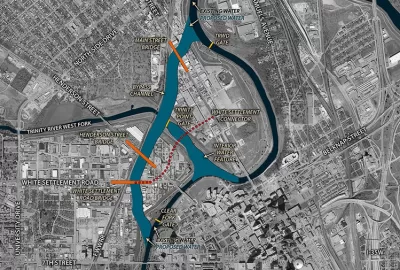
A massive riverfront district in Fort Worth, Texas could be up for a reimagining after a new report that calls on the city to reconsider the plan for the area. Jenny Rudolph, Harrison Mantas, and Abby Church outline the report’s findings in the Fort Worth Star-Telegram.
As the article explains, “The $1.1 billion public investment to mitigate Trinity River flooding by building new channels will open up more than 5 miles of shoreline and 200 acres for development just north of downtown. As originally conceived, Panther Island’s development would be focused on dense residential buildings with some commercial.”
Now, the report from a consultant firm calls for more mixed-use development in Panther Island and “stresses the need for a unified development strategy for the more than 500 acres of public and privately owned land, as well as the need to avoid displacing surrounding communities such as the historic North Side.”
“Planners are moving away from the residential-focused original plans and instead envision a district with a vibrant entertainment hub, outdoor recreation and the potential to attract companies and talent to the city, HR&A’s report said.” The report adds that the district should be pedestrian-friendly, accessible, and have a “recognizable and distinct identity while also complementing the adjacent downtown and connecting seamlessly with surrounding neighborhoods.”
According to the article, “Although conceived years ago, the project got an official greenlight in January 2022 when the U.S. Army Corps of Engineers received $403 million from the federal government to create the bypass channel connecting two sections of the Trinity River.”
Read the full story: The vision for Fort Worth’s Panther Island is changing. Here’s what a new report says.

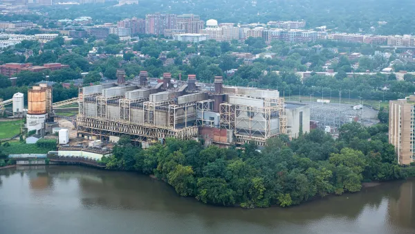
Former power plant in Alexandria to become walkable waterfront neighborhood with 800 homes
The Potomac River Generating Station was once the biggest source of air pollution in northern Virginia.
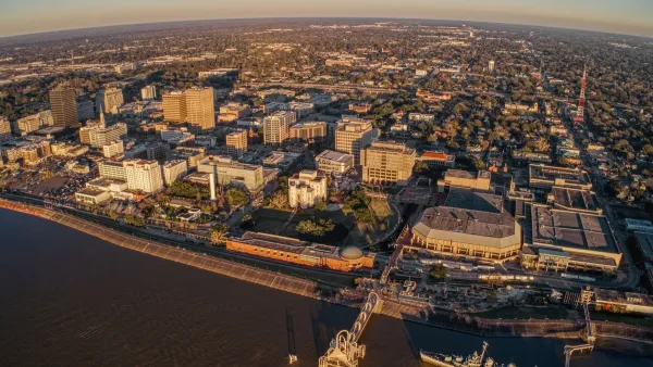
Baton Rouge master plan aims to triple downtown population
The Louisiana capital wants to entice developers to its riverfront district.

The Simple Legislative Tool Transforming Vacant Downtowns
In California, Michigan and Georgia, an easy win is bringing dollars — and delight — back to city centers.

Planetizen Federal Action Tracker
A weekly monitor of how Trump’s orders and actions are impacting planners and planning in America.

California plans to bury El Niño’s downpour
If the state plays its cards right, it may be able to store a billion acre-feet of El Niño’s water in aquifers.

Desperate measures: Advocates weigh draining Lake Powell to fill Colorado River
Draining the reservoir could reduce evaporation losses by a couple hundred thousand acre-feet.

California city breaks ground on transit connector
The project includes three mobility hubs and a pedestrian bridge.

After public outcry, Massachusetts city releases housing development tracker
Cambridge’s tracker currently shows 250 housing projects in various stages of development.

40 years after approval, Chicago breaks ground on new park
The park honors Jean Baptiste Point du Sable, the city’s first permanent non-native settler.

FREE Course: Walkable City 1: Why Walkability?
After describing his path towards focusing on walkability as the essence of good planning, Jeff Speck marches through his five principal reasons for making more walkable places.
Reinventing Malls: Planning Alchemy—Turning Gray Fields Into Gold
The course focuses on the opportunities and imperatives that shape reinvention of mall sites.

City of Rosemead
Rutgers University, Edward J. Bloustein School of Planning and Public Policy
One Hundred Miles
Hunter College, City University of New York (CUNY)
The Architects Foundation
University of Cincinnati Online
City of Cambridge
Montrose County
The Pocatello Development Authority