


Zoning can limit more than just multi-family housing.
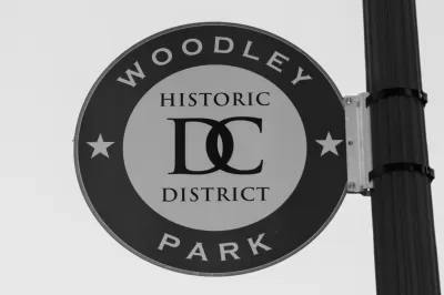
The D.C. Office of Planning recently released a draft report to evaluate the potential of raising a cap on the number of restaurants and bars allowed in the neighborhoods of Cleveland Park and Woodley Park.
Zoning currently allows “no more than 25% of the linear street frontage within a particular zone can be occupied by bars and restaurants,” according to an article by Amanda Michelle Gomez.
Planning Director Anita Cozart is quoted in the article saying that the original intention of the rule was to encourage a variety of businesses in the area, but residents and businesses have come to view the cap as a limitation on local businesses.
According to the article, the D.C. Office of Planning is considering changes to the cap as part of its effort to implement the District’s Comprehensive Plan.
“The neighborhoods have historically excluded multifamily buildings and minimized commercial uses, leading to low population growth and high household incomes as compared to the rest of the city, according to the planning office’s draft report,” writes Gomez. “Options on the table include increasing the percentage of retail space that can be devoted to bars and restaurants, from 25% to 50% or 75%, or removing the cap entirely.”
More details on the goals and timeline for the zoning changes in the D.C. neighborhoods of Cleveland Park and Woodley Park.
FULL STORY: Should Cleveland Park, Woodley Park get more restaurants? A growing number of residents say yes


Boston to Begin Zoning Code Update, Mayor Announces
It’s been nearly 60 years, but the city of Boston is finally ready to do a comprehensive rewrite of its zoning code.

Columbus Rewriting its Zoning Code
Planners in Ohio’s capital city hope a new zoning code will help reverse some of the damage done by the city’s previous zoning codes.

Zoning Reform: New Politics, Same Old Challenges
The political will for zoning reforms has never been stronger. The traditional opponents of development, however, are still finding ways to push back.

Planetizen Federal Action Tracker
A weekly monitor of how Trump’s orders and actions are impacting planners and planning in America.

Chicago’s Ghost Rails
Just beneath the surface of the modern city lie the remnants of its expansive early 20th-century streetcar system.

San Antonio and Austin are Fusing Into one Massive Megaregion
The region spanning the two central Texas cities is growing fast, posing challenges for local infrastructure and water supplies.

Since Zion's Shuttles Went Electric “The Smog is Gone”
Visitors to Zion National Park can enjoy the canyon via the nation’s first fully electric park shuttle system.

Trump Distributing DOT Safety Funds at 1/10 Rate of Biden
Funds for Safe Streets and other transportation safety and equity programs are being held up by administrative reviews and conflicts with the Trump administration’s priorities.

German Cities Subsidize Taxis for Women Amid Wave of Violence
Free or low-cost taxi rides can help women navigate cities more safely, but critics say the programs don't address the root causes of violence against women.
Urban Design for Planners 1: Software Tools
This six-course series explores essential urban design concepts using open source software and equips planners with the tools they need to participate fully in the urban design process.
Planning for Universal Design
Learn the tools for implementing Universal Design in planning regulations.
planning NEXT
Appalachian Highlands Housing Partners
Mpact (founded as Rail~Volution)
City of Camden Redevelopment Agency
City of Astoria
City of Portland
City of Laramie