


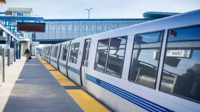
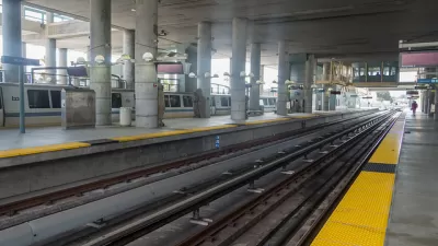
Planners presented two options for new tunnels that would help connect more parts of the Northern California megaregion to San Francisco and Oakland.

Plans for a new tunnel across the San Francisco Bay are shaping up as the public finally got a look at “the most detailed maps yet” showing the proposed tunnel’s route. As Benjamin Schneider reports for the San Francisco Examiner, planners for the Link21 project revealed two options for the tunnel. “One shows BART and regional rail trains — like Capitol Corridor or Caltrain — traveling side by side in a shared alignment from Oakland and Alameda to the Salesforce Transit Center in San Francisco.”
The second option would have two tunnels separating BART and regional trains. “Both plans hint at the possibility of a BART subway down Geary Boulevard, with the blue arrows pointing west from downtown San Francisco and labeled as a ‘possible extension.’”
Across the bay in Oakland, “Jack London Square, where the A’s are hoping to build a massive development anchored by a new ballpark, and West Oakland could become major transit hubs, hosting both BART stations and regional rail stations.”
Link21 is named for the 21 counties that could be served by new connections enabled by the project.
Schneider notes that “Link21 remains a long way from reality. Project planning and approvals are expected to last through 2027. Completion is roughly projected for 2039.”
FULL STORY: A new train tunnel across the Bay? Here are early maps

San Francisco’s BART Awarded $545 Loan for Upgraded Rail Cars
The agency plans to modernize its fleet with more efficient rail cars equipped with new safety features.
Is Pay by Distance Unfair to the Poor?
Sam Raby argues that BART’s pay by distance fair structure exacerbates transit inequities.

The Subversive Car-Free Guide to Trump's Great American Road Trip
Car-free ways to access Chicagoland’s best tourist attractions.

Maui's Vacation Rental Debate Turns Ugly
Verbal attacks, misinformation campaigns and fistfights plague a high-stakes debate to convert thousands of vacation rentals into long-term housing.

Planetizen Federal Action Tracker
A weekly monitor of how Trump’s orders and actions are impacting planners and planning in America.

In Urban Planning, AI Prompting Could be the New Design Thinking
Creativity has long been key to great urban design. What if we see AI as our new creative partner?

King County Supportive Housing Program Offers Hope for Unhoused Residents
The county is taking a ‘Housing First’ approach that prioritizes getting people into housing, then offering wraparound supportive services.

Researchers Use AI to Get Clearer Picture of US Housing
Analysts are using artificial intelligence to supercharge their research by allowing them to comb through data faster. Though these AI tools can be error prone, they save time and housing researchers are optimistic about the future.

Making Shared Micromobility More Inclusive
Cities and shared mobility system operators can do more to include people with disabilities in planning and operations, per a new report.
Urban Design for Planners 1: Software Tools
This six-course series explores essential urban design concepts using open source software and equips planners with the tools they need to participate fully in the urban design process.
Planning for Universal Design
Learn the tools for implementing Universal Design in planning regulations.
planning NEXT
Appalachian Highlands Housing Partners
Mpact (founded as Rail~Volution)
City of Camden Redevelopment Agency
City of Astoria
City of Portland
City of Laramie