


The city of Danville, located along the Easy Bay Area’s I-680 corridor, last week approved a new master plan for its downtown, with funding for implementation made possible by the American Rescue Plan Act.
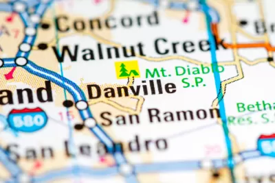
Jeanita Lyman reports on a new master plan for Danville, just prior to a vote by the Danville City Council to approve the plan. The article cites Jill Bergman, Danville's business and economic development director, to describe the plan as a response to the economic disruptions of the Covid-19 pandemic.
“The proposed update aims to address the top three priorities identified in a number of public outreach efforts. These consist of improvements along Hartz Avenue, expansions to the Theatre Plaza and public plaza at Hartz Avenue and Prospect Street, and addressing traffic safety concerns,” writes Lyman.
Street configuration changes will include intersection bulb-outs, raised intersection tables, and ‘expanded areas at intersections for specialty art lighting to enhance nighttime visibility.’
Bergman also informs readers that Danville has funding from the American Rescue Plan Act to fund some of the implementation of the plan.
FULL STORY: Danville council to vote on Downtown Master Plan update


Building on Recent Planning Success in Akron
Following the success of Planning to Grow Akron, spurring the development of thousands of housing units in the previously stagnant city, Planning to Grow Akron 2.0 will leverage federal stimulus funds to further stabilize the city's housing market.
'American Jobs Plan': Potential Sea Change for Federal Infrastructure Spending
After a week of speculation and rumor, the Biden administration today revealed its promised infrastructure plan.

Placemaking Redefined by a New Era of Federal Investment
Six tips for ensuring that new placed-based funding programs, such as the Build Back Better Regional Challenge, achieve the full potential of a new era of place-based federal investment.

Maui's Vacation Rental Debate Turns Ugly
Verbal attacks, misinformation campaigns and fistfights plague a high-stakes debate to convert thousands of vacation rentals into long-term housing.

Planetizen Federal Action Tracker
A weekly monitor of how Trump’s orders and actions are impacting planners and planning in America.

Chicago’s Ghost Rails
Just beneath the surface of the modern city lie the remnants of its expansive early 20th-century streetcar system.

Bend, Oregon Zoning Reforms Prioritize Small-Scale Housing
The city altered its zoning code to allow multi-family housing and eliminated parking mandates citywide.

Amtrak Cutting Jobs, Funding to High-Speed Rail
The agency plans to cut 10 percent of its workforce and has confirmed it will not fund new high-speed rail projects.

LA Denies Basic Services to Unhoused Residents
The city has repeatedly failed to respond to requests for trash pickup at encampment sites, and eliminated a program that provided mobile showers and toilets.
Urban Design for Planners 1: Software Tools
This six-course series explores essential urban design concepts using open source software and equips planners with the tools they need to participate fully in the urban design process.
Planning for Universal Design
Learn the tools for implementing Universal Design in planning regulations.
planning NEXT
Appalachian Highlands Housing Partners
Mpact (founded as Rail~Volution)
City of Camden Redevelopment Agency
City of Astoria
City of Portland
City of Laramie