


New data reveals truths about one of the biggest questions to emerge from the pandemic: Did the public health risks and economic disruptions of 2020 and 2021 spur an urban exodus away from the urban cores of large metropolitan areas?

“With national population growth at a record low, domestic migration was the key component of population change on the state and local levels in 2021,” writes Riordan Frost, senior research analyst at the Joint Center for Housing Studies of Harvard University (JCHS).
Citing data first reported by JCHS in the “2022 State of the Nation’s Housing” report, published in June, Riordan describes migration patterns that tilt heavily toward the U.S. south, with the states of Texas, Tennessee, North Carolina, South Carolina, Georgia, and Florida each attracting more than 50,000 new residents during the pandemic. California, Illinois, and New York lost more than 50,000 residents.
Focusing on the county level, Riordan describes a pattern of “large urban counties losing domestic migrants and suburban areas around these counties gaining migrants.”
Another key finding reported in the article: a larger number of rural counties gaining residents in 2021 than in 2019.
The JCHS isn’t the only institution to report new migration numbers in recent weeks. The Federal Reserve Bank of Cleveland also released a new data update for the second quarter of 2022 as part of its ongoing research [pdf] into the question of whether the pandemic caused an urban exodus. According to the Cleveland Fed, “migration flows were in fact very unfavorable for urban neighborhoods in 2020.”
FULL STORY: DOMESTIC MIGRATION DROVE STATE AND LOCAL POPULATION CHANGE IN 2021


Low-Income Residents Less Likely to Move During the Pandemic, Freddie Mac Says
Does low-income residents staying put in large metro areas, relative to higher-income groups, mean that low-income households are missing out on affordable housing options? Freddie Mac researchers think so.

Analysis: Pandemic Pressed Fast Forward on U.S. Migration Trends
In Las Vegas, Denver, Philadelphia, and more, out of town newcomers have been driving up real estate prices by moving in from more expensive locations with the resources to outspend locals, according to analysis by the Business Journals.
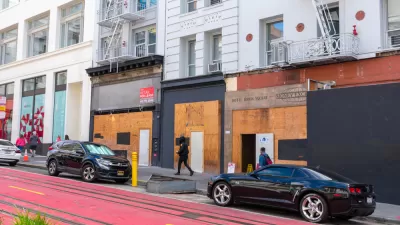
The Demographics of San Francisco’s Pandemic Urban Exodus
New Census data break down San Francisco’s population losses during the first year-plus of the pandemic by race and age.

Planetizen Federal Action Tracker
A weekly monitor of how Trump’s orders and actions are impacting planners and planning in America.

Chicago’s Ghost Rails
Just beneath the surface of the modern city lie the remnants of its expansive early 20th-century streetcar system.

San Antonio and Austin are Fusing Into one Massive Megaregion
The region spanning the two central Texas cities is growing fast, posing challenges for local infrastructure and water supplies.

Since Zion's Shuttles Went Electric “The Smog is Gone”
Visitors to Zion National Park can enjoy the canyon via the nation’s first fully electric park shuttle system.

Trump Distributing DOT Safety Funds at 1/10 Rate of Biden
Funds for Safe Streets and other transportation safety and equity programs are being held up by administrative reviews and conflicts with the Trump administration’s priorities.

German Cities Subsidize Taxis for Women Amid Wave of Violence
Free or low-cost taxi rides can help women navigate cities more safely, but critics say the programs don't address the root causes of violence against women.
Urban Design for Planners 1: Software Tools
This six-course series explores essential urban design concepts using open source software and equips planners with the tools they need to participate fully in the urban design process.
Planning for Universal Design
Learn the tools for implementing Universal Design in planning regulations.
planning NEXT
Appalachian Highlands Housing Partners
Mpact (founded as Rail~Volution)
City of Camden Redevelopment Agency
City of Astoria
City of Portland
City of Laramie