


The county completed the draft environmental impact study for a monorail and people mover planned as part of its rapid transit system.
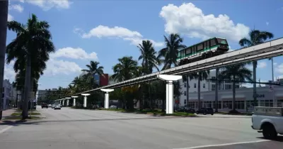
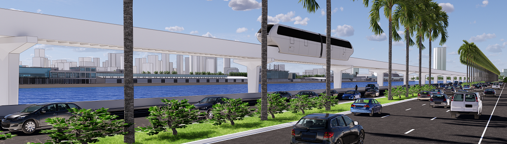
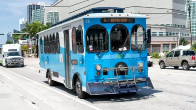
According to an article in The Next Miami, Miami-Dade County has issued the draft environmental study for a rapid transit line that would connect downtown Miami and Miami Beach as part of the Strategic Miami Area Rapid Transit (SMART) Program. “The study covers the Beach Corridor Trunkline from the existing Metromover system in Downtown Miami to 5th Street and Washington Avenue in the City of Miami Beach.”
The project would include a monorail to Miami Beach and a “Metromover-type system” to the city’s Design District.
As noted in the study’s executive summary, “The purpose of this project is to increase the person-throughput to the Beach Corridor’s major origins and destinations via a rapid transit technology. The need for the project is the extensive population growth throughout the study area, resulting in ever-increasing traffic congestion and the demand for enhanced access to the area’s employment centers, facilities and services.”
Critics of the project question the price tag, which ballooned to over $1 billion from the original estimate of $587 million.
FULL STORY: Studies Completed For Miami Beach Rapid Transit, People Mover To Design District

Miami-Dade Building Electric Bus Operations Center
The 20-acre facility will help the county reach its goal of electrifying 20 percent of its bus fleet.
Inglewood Transit Connector Moves Forward
The project entered the engineering phase and received just over $1 billion in federal funding last week.
Miami-Dade County Suspends Transit Fares for Rest of 2023
Starting November 13, bus and rail rides will be free as the county rolls out its ‘Better Bus’ system redesign.

Planetizen Federal Action Tracker
A weekly monitor of how Trump’s orders and actions are impacting planners and planning in America.

Maui's Vacation Rental Debate Turns Ugly
Verbal attacks, misinformation campaigns and fistfights plague a high-stakes debate to convert thousands of vacation rentals into long-term housing.

San Francisco Suspends Traffic Calming Amidst Record Deaths
Citing “a challenging fiscal landscape,” the city will cease the program on the heels of 42 traffic deaths, including 24 pedestrians.

Defunct Pittsburgh Power Plant to Become Residential Tower
A decommissioned steam heat plant will be redeveloped into almost 100 affordable housing units.

Trump Prompts Restructuring of Transportation Research Board in “Unprecedented Overreach”
The TRB has eliminated more than half of its committees including those focused on climate, equity, and cities.

Amtrak Rolls Out New Orleans to Alabama “Mardi Gras” Train
The new service will operate morning and evening departures between Mobile and New Orleans.
Urban Design for Planners 1: Software Tools
This six-course series explores essential urban design concepts using open source software and equips planners with the tools they need to participate fully in the urban design process.
Planning for Universal Design
Learn the tools for implementing Universal Design in planning regulations.
Heyer Gruel & Associates PA
JM Goldson LLC
Custer County Colorado
City of Camden Redevelopment Agency
City of Astoria
Transportation Research & Education Center (TREC) at Portland State University
Jefferson Parish Government
Camden Redevelopment Agency
City of Claremont