


After one city councilmember refused to advocate for changing parking rules in his district, Philadelphia’s Washington Avenue could end up with two different safety configurations.
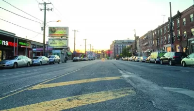
With a plan to repave 2.1 miles of Philadelphia’s Washington Avenue in place, road safety advocates hoped the street would also receive a road diet and traffic calming features, writes Thomas Fitzgerald in The Philadelphia Inquirer. “But Councilmember Kenyatta Johnson on Thursday declined to introduce legislation changing parking rules on the part of the avenue in his district, meaning it would be repaved but stay five lanes wide.” Meanwhile, “Councilmember Mark Squilla introduced a bill enabling parking and loading-zone changes on Washington Avenue in his district, from Fourth Street to Broad Street,” meaning the street will have two different safety configurations.
While Johnson says he supports traffic calming measures, “he wants Washington Avenue to remain five lanes through the 2nd District, reflecting the needs and concerns of residents and business owners,” which the city’s Office of Transportation, Infrastructure, and Sustainability (OTIS) says could impede the installation of other safety measures.
“The mixed plan came after a backlash against OTIS’ original plan, announced in September 2020, to narrow the entire 2.1-mile stretch of Washington Avenue from five vehicle travel lanes to three — a design meant to cut vehicle crashes, make walking safer, and protect cyclists by placing bike lanes between parked cars and curbs.”
FULL STORY: After all that, Washington Avenue could end up with two separate safety configurations

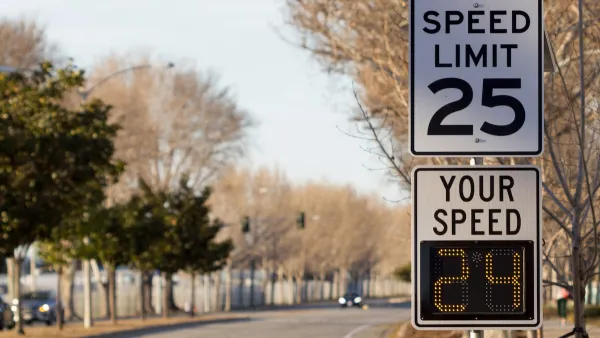
Philadelphia Launches ‘Speed Slots’ Traffic Calming Pilot
The project focuses on a 1.4-mile stretch of Lincoln Drive where cars frequently drive above the posted speed limit.

Philly Speed Camera Program Cuts Fatalities in Half
Excessive speeding along dangerous segments of Roosevelt Boulevard dropped by 90 percent after the city installed automated enforcement cameras.

Maryland Plans Quick-Build Complete Streets Projects
The state will use low-cost interventions to improve road safety in five Maryland counties.

Maui's Vacation Rental Debate Turns Ugly
Verbal attacks, misinformation campaigns and fistfights plague a high-stakes debate to convert thousands of vacation rentals into long-term housing.

Planetizen Federal Action Tracker
A weekly monitor of how Trump’s orders and actions are impacting planners and planning in America.

In Urban Planning, AI Prompting Could be the New Design Thinking
Creativity has long been key to great urban design. What if we see AI as our new creative partner?

King County Supportive Housing Program Offers Hope for Unhoused Residents
The county is taking a ‘Housing First’ approach that prioritizes getting people into housing, then offering wraparound supportive services.

Researchers Use AI to Get Clearer Picture of US Housing
Analysts are using artificial intelligence to supercharge their research by allowing them to comb through data faster. Though these AI tools can be error prone, they save time and housing researchers are optimistic about the future.

Making Shared Micromobility More Inclusive
Cities and shared mobility system operators can do more to include people with disabilities in planning and operations, per a new report.
Urban Design for Planners 1: Software Tools
This six-course series explores essential urban design concepts using open source software and equips planners with the tools they need to participate fully in the urban design process.
Planning for Universal Design
Learn the tools for implementing Universal Design in planning regulations.
planning NEXT
Appalachian Highlands Housing Partners
Mpact (founded as Rail~Volution)
City of Camden Redevelopment Agency
City of Astoria
City of Portland
City of Laramie