


The project, led by Gensler, will span 39 acres of residential units, retail, and cultural attractions.

New Orleans "is slated to join the nationwide trend towards megadevelopments with the 39-acre River District, a new 2.4 million square-feet mixed-use district upriver from New Orleans’s Crescent City Connection Bridge," writes Matthew Marani in The Architect's Newspaper. The project's design will be led by Gensler and a group of partners known as the River District Neighborhood LLC. "In its proposal, the River District Neighborhood noted that the project will include over 1,000 market-rate residential units, 450 workforce and affordable housing units, a 750,000 square-foot corporate campus, as well as a number of cultural attractions, retail and dining, hotels, public parks, art installations, and the Louisiana Civil Rights Museum."
The first phase of construction, which is scheduled to start this year and last until 2023, " will focus on road and sidewalk construction and other infrastructure improvements, as well as the museum, nearly 100,000 square feet of retail, and two hotels." The proposal, Marani says, "does attempt to connect to the city at large through several planning features, namely the potential $40 million extension of the Riverwalk streetcar line into the area, a number of protected bike lanes, as well as pedestrian-friendly street layouts." Addressing criticism about displacement, the developers claim that "approximately 30 percent of retail space will be reserved for disadvantaged business enterprise, also known as DBEs, and that the River District Neighborhood LLC counts 27 percent African American equity ownership as well as 18 percent women equity ownership."
FULL STORY: Gensler to lead design of the $1 billion New Orleans River District

When The Planners Go Marching In
There’s just one problem with academia. Sometimes it can be so … academic. In the interest of getting out into the world, I’m writing this post from Nawlins (nee New Orleans), where 16 other Penn planners and I are spending our weeklong spring break doffing our tops for beads and booze doing pro bono city planning work. For most of us, it’s been nothing short of a paradigm shift—and the week ain’t over yet.
Friday Funny: Rats Prefer Manhattan
Rats choose Manhattan because if its logical street grid, according to new research by a team of zoologists and geographers at Tel Aviv University, who are using rats to test wayfinding in cities.
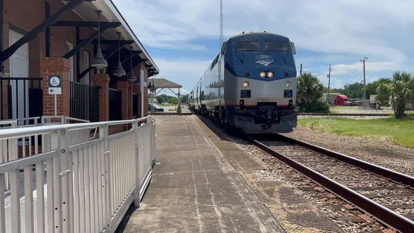
Amtrak Rolls Out New Orleans to Alabama “Mardi Gras” Train
The new service will operate morning and evening departures between Mobile and New Orleans.

Planetizen Federal Action Tracker
A weekly monitor of how Trump’s orders and actions are impacting planners and planning in America.

Maui's Vacation Rental Debate Turns Ugly
Verbal attacks, misinformation campaigns and fistfights plague a high-stakes debate to convert thousands of vacation rentals into long-term housing.

San Francisco Suspends Traffic Calming Amidst Record Deaths
Citing “a challenging fiscal landscape,” the city will cease the program on the heels of 42 traffic deaths, including 24 pedestrians.

Defunct Pittsburgh Power Plant to Become Residential Tower
A decommissioned steam heat plant will be redeveloped into almost 100 affordable housing units.

Trump Prompts Restructuring of Transportation Research Board in “Unprecedented Overreach”
The TRB has eliminated more than half of its committees including those focused on climate, equity, and cities.

Amtrak Rolls Out New Orleans to Alabama “Mardi Gras” Train
The new service will operate morning and evening departures between Mobile and New Orleans.
Urban Design for Planners 1: Software Tools
This six-course series explores essential urban design concepts using open source software and equips planners with the tools they need to participate fully in the urban design process.
Planning for Universal Design
Learn the tools for implementing Universal Design in planning regulations.
Heyer Gruel & Associates PA
JM Goldson LLC
Custer County Colorado
City of Camden Redevelopment Agency
City of Astoria
Transportation Research & Education Center (TREC) at Portland State University
Jefferson Parish Government
Camden Redevelopment Agency
City of Claremont