A new methodology can help cities assess the impact of new developments on walkers.


While planners frequently use forecasting models to predict the impact of new developments on traffic, congestion, and road quality, no such model existed for assessing the effects of development on non-drivers. Now, reports Kea Wilson for Streetsblog, "Massachusetts Institute of Technology Researcher Andres Sevstuk has created a sophisticated new methodology for estimating changes in the volume of walkers on city streets at different times throughout the day in response to changes in the built environment, in much the same way that planners estimate how vehicle traffic will change after they break ground on a building or roadway redesign."
Similar traffic impact assessments (TIAs) are frequently used to evaluate the impact of projects. According to researcher Andres Sevstuk, "if the TIA forecast that a project would put more traffic onto city streets than the current road design can tolerate, then the developer typically has to pay to address that — maybe by building extra parking, or paying to widen a road, or paying to adjust traffic signal timing." Sevstuk argues that adding more infrastructure for counting pedestrians could have a "dramatic effect" on our understanding of how land use affects walking in cities.
Sevstuk's model, writes Wilson, "would be re-calibrated by each community using at least some local walking data, but even without those inputs, it can predict pedestrian volumes with roughly 70 to 80 percent accuracy." This information can help cities decide where to build amenities like parks or parking lots and serve as "a critical tool to identify where to prioritize pedestrian improvements that planners haven’t even considered yet." Further, "[o]verlaying projections with actual pedestrian crash data and data on corridors that have been historically disinvested could be even more helpful as leaders work towards ending traffic violence and making cities more equitable."
Read the full story: New Traffic Model Predicts How New Developments Will Affect Walkers

'The World's Most Beautiful Avenue' Getting A Green Makeover
Paris Mayor Anne Hidalgo approved a new plan to revitalize the Champs Élysées ahead of the 2024 Summer Olympics.

The number of kids walking to school dropped from over 50% to 11% since the 1960s
Unsafe pedestrian infrastructure makes walking to school dangerous or impossible for a growing number of American students.
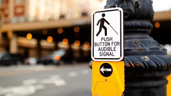
Report: Chicago surpassed its legal mandate for accessible pedestrian signals — but none passed inspections
Gaps in accessibility, placement and functionality highlight the importance of regular inspections and maintenance.

Planetizen Federal Action Tracker
A weekly monitor of how Trump’s orders and actions are impacting planners and planning in America.

California plans to bury El Niño’s downpour
If the state plays its cards right, it may be able to store a billion acre-feet of El Niño’s water in aquifers.

Desperate measures: Advocates weigh draining Lake Powell to fill Colorado River
Draining the reservoir could reduce evaporation losses by a couple hundred thousand acre-feet.

Mamdani’s pied-à-terre tax survives legal challenge
A panel of judges found that the plaintiffs failed to demonstrate injury as a result of New York City's implementation of the tax.

Eastern Nebraska is running out of electricity
Data centers and electrification are straining eastern Nebraska’s grid, throttling economic development.

Seattle passes record-breaking transit services expansion
Proposition 1 will double the city’s transit tax to add 95,000 more bus trips and preserve 180,000 bus trips annually.

FREE Course: Walkable City 1: Why Walkability?
After describing his path towards focusing on walkability as the essence of good planning, Jeff Speck marches through his five principal reasons for making more walkable places.
Reinventing Malls: Planning Alchemy—Turning Gray Fields Into Gold
The course focuses on the opportunities and imperatives that shape reinvention of mall sites.

City of Rosemead
Rutgers University, Edward J. Bloustein School of Planning and Public Policy
One Hundred Miles
University of Michigan School for Environment and Sustainability (SEAS)
Hunter College, City University of New York (CUNY)
The Architects Foundation
City of Cambridge
Montrose County
The Pocatello Development Authority