


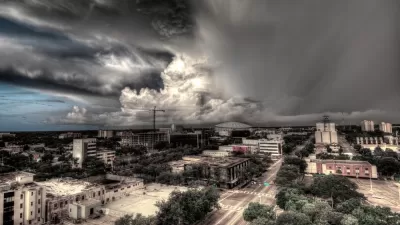
The area is especially vulnerable to storm surge, and increased development means more people are at risk when major hurricanes push through.
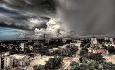
"Tampa Bay is long and grows narrower and shallower as you move farther away from the Gulf of Mexico and toward the cities of St. Petersburg and Tampa, Florida. When a hurricane comes through Tampa Bay, its winds can push a wall of water, known as storm surge, into this ever-tightening container. So when a storm comes through, the bay rises," writes Brian Resnick.
Tampa Bay’s geography, together with growing population and its location in a hurricane-prone area, makes cities in the region more vulnerable to climate change and the more destructive hurricanes that are likely in the future.
While the Tampa Bay Regional Planning Council drafted a catastrophic plan called Project Phoenix a decade ago, Resnick says local governments have not pursued policies to prepare the region for sea-level rise and flooding threats. "Namely, development continues at a huge pace and few buildings are hurricane proof."
Experts suggest more stringent building standards, denser development further inland, and improved evacuation plans. "The more the Tampa Bay area grows, the more people will be at risk for storms and sea-level rise. Again: We know that more storms are coming. They’ve come before. And they’ll keep coming, whether we’re here or not," notes Resnick.
FULL STORY: 26 feet of water: What the worst-case hurricane scenario looks like for Tampa Bay

Homeland Security Advisor Recognizes Effects of Climate Change, Ignores Causes
In response to a question linking Hurricanes Irma and Harvey to climate change, White House Homeland Security Advisor Tom Bossert appeared to recognize the need to adapt. He qualified his statement regarding the "cause" of said climate change.
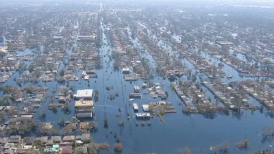
A Hurricane in Tampa Bay Could Surpass Katrina's Destruction
It's been a century since a hurricane larger than category three has scored a direct hit on the Tampa Bay region. If a storm arrives to change that streak of luck, it will find a region severly underprepared to deal with the effects of sea-level rise
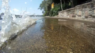
Living With Record Tides in Florida's Key Largo
South Florida's annual "king tides" were especially brutal this year. Residents of one Florida Keys community have experienced what it's like to live on the front lines of sea level rise.

Maui's Vacation Rental Debate Turns Ugly
Verbal attacks, misinformation campaigns and fistfights plague a high-stakes debate to convert thousands of vacation rentals into long-term housing.

Planetizen Federal Action Tracker
A weekly monitor of how Trump’s orders and actions are impacting planners and planning in America.

Chicago’s Ghost Rails
Just beneath the surface of the modern city lie the remnants of its expansive early 20th-century streetcar system.

Bend, Oregon Zoning Reforms Prioritize Small-Scale Housing
The city altered its zoning code to allow multi-family housing and eliminated parking mandates citywide.

Amtrak Cutting Jobs, Funding to High-Speed Rail
The agency plans to cut 10 percent of its workforce and has confirmed it will not fund new high-speed rail projects.

LA Denies Basic Services to Unhoused Residents
The city has repeatedly failed to respond to requests for trash pickup at encampment sites, and eliminated a program that provided mobile showers and toilets.
Urban Design for Planners 1: Software Tools
This six-course series explores essential urban design concepts using open source software and equips planners with the tools they need to participate fully in the urban design process.
Planning for Universal Design
Learn the tools for implementing Universal Design in planning regulations.
planning NEXT
Appalachian Highlands Housing Partners
Mpact (founded as Rail~Volution)
City of Camden Redevelopment Agency
City of Astoria
City of Portland
City of Laramie