


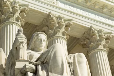
On June 27, the Supreme Court didn't just rule on the Census Bureau's citizenship question. It also decided that it wasn't their business to consider how congressional districts are drawn, which will likely reduce the influence of cities.
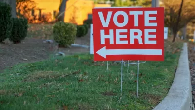
"The Supreme Court ruled on Thursday that the federal courts cannot decide a question with momentous political consequences: Whether congressional district maps in Maryland and North Carolina that were drawn specifically to tilt political power in favor of one party — a practice known as partisan gerrymandering — are acceptable," reports Michael Wines, who writes about voting and other election-related issues for The New York Times, on June 27.
In the end, the Supreme Court decided, 5-4, that the question of partisan gerrymandering was a political one that must be resolved by the elected branches of government, and not a legal question that the federal courts should decide.
“We conclude that partisan gerrymandering claims present political questions beyond the reach of the federal courts,” Chief Justice John G. Roberts Jr. wrote in the majority opinion [pdf].
The outcome of this decision goes beyond political parties and to the heart of many contemporary planning policies that are posted here daily, particularly as they relate to the urban-rural divide. Referencing the 2008 Gerrymandering Index White Paper from Philadelphia-based Azavea, CityLab's Brentin Mock wrote in January 2017:
Ever wonder why your city’s bridges can’t get fixed or can’t get that fleet of clean energy buses, but you keep seeing new lanes added to suburban highways? It’s because your city is likely condensed within a small minority of state legislative districts that are far outnumbered by the districts that represent rural and outer-rim suburbs.
Those non-city districts typically are loaded with conservative voters who care little about density or public transit or affordable housing. Indeed, many moved to these exurban settings specifically so that they do not have to entertain such urban entreaties.
Wines of the Times reinforces that political observation.
Currently, rigged maps tend to be most prevalent, and most tilted, in states under Republican control. That is in part because Republicans did exceptionally well in the 2010 elections, giving the party far wider control of state legislatures, which oversaw redistricting after the 2010 census. The national Republican Party had poured money and expertise into state legislative races with the specific aim of gaining control over redistricting; the Democratic Party had not.
Mock goes on to write how city voters regularly get shortchanged from partisan gerrymandering.
They may hold the edge in population, but they can’t match the land mass of their suburban and rural complements, where the borders game is quite advantageous.
The two cases, Lamone v. Benisek, brought by Republican voters in Maryland, and Rucho v. Common Cause, filed by the non-partisan, non-profit group, Common Cause, against the North Carolina legislature, were consolidated by the Supreme Court in January. Robert Rucho, a Republican, had been the chairman of the North Carolina Senate Redistricting Committee.
Jelani Cobb of the New Yorker writes that the decision "legitimized one of the cornerstone elements of voter suppression in the United States."
Aided by new software that maximizes partisan advantage, state legislatures, which are overwhelmingly in the hands of Republicans, have redrawn voting districts largely to the disadvantage of Democrats. The technology has enabled gerrymandering to such an extent that it effectively nullifies the possibility of equal representation for voters.
The last words go to a representative for the plaintiff, Kathay Feng of Common Cause:
“In a democracy, voters should choose their politicians, not the other way around, on Election Day.
“But the Supreme Court today gave the green light to the most extreme partisan gerrymanders, where legislators openly boasted about their partisan motives, stripping not only the people of North Carolina and Maryland, but all Americans, of the right to fair representation.
“To bring about fair maps, the people must continue to make their voice heard through ballot initiatives, new state laws, and appeals to state courts to reform the redistricting process. "
Related in Planetizen:
- Updated: Census Citizenship Question Officially Cancelled, July 3, 2019
-
Can an Algorithm Cure Gerrymandering? June 9, 2014
-
Congressional Redistricting Leaves Cities Split, December 7, 2011
FULL STORY: What Is Gerrymandering? And Why Did the Supreme Court Rule on It?


U.S. Supreme Court Rules on State-Imposed Social Distancing Restrictions
In a 5-4 decision, the court voted to uphold the prohibition of religious services that was part of California Gov. Gavin Newsom's stay-at-home order. While the restriction had since been loosened, the plaintiff wanted all restrictions removed.

Déjà Vu: Republican Legislators Flee From Capitol to Stall Climate Bill
Republican state lawmakers repeated a tactic they successfully deployed last summer to prevent the passage of a bill that would have made Oregon the second state, after California, to place a price on carbon emissions from most economic sectors.
The Crucial Role of Suburban Voters in the Midterms
Suburban voters were instrumental in preventing a 'red wave' on Election Day and on December 6 in the Georgia U.S. Senate runoff election, enabling the Democrats to win a 51st Senate seat.

Maui's Vacation Rental Debate Turns Ugly
Verbal attacks, misinformation campaigns and fistfights plague a high-stakes debate to convert thousands of vacation rentals into long-term housing.

Planetizen Federal Action Tracker
A weekly monitor of how Trump’s orders and actions are impacting planners and planning in America.

San Francisco Suspends Traffic Calming Amidst Record Deaths
Citing “a challenging fiscal landscape,” the city will cease the program on the heels of 42 traffic deaths, including 24 pedestrians.

Defunct Pittsburgh Power Plant to Become Residential Tower
A decommissioned steam heat plant will be redeveloped into almost 100 affordable housing units.

Trump Prompts Restructuring of Transportation Research Board in “Unprecedented Overreach”
The TRB has eliminated more than half of its committees including those focused on climate, equity, and cities.

Amtrak Rolls Out New Orleans to Alabama “Mardi Gras” Train
The new service will operate morning and evening departures between Mobile and New Orleans.
Urban Design for Planners 1: Software Tools
This six-course series explores essential urban design concepts using open source software and equips planners with the tools they need to participate fully in the urban design process.
Planning for Universal Design
Learn the tools for implementing Universal Design in planning regulations.
Heyer Gruel & Associates PA
JM Goldson LLC
Custer County Colorado
City of Camden Redevelopment Agency
City of Astoria
Transportation Research & Education Center (TREC) at Portland State University
Jefferson Parish Government
Camden Redevelopment Agency
City of Claremont