


The environmental impact report for the North Houston Highway Improvement Project is still underway, after 15 years of planning, but it's not too early to imagine the consequences of this massive project.
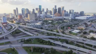
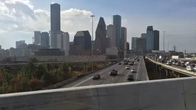
William Fulton kicks off a series on a massive highway project in Houston that will widen Interstate 45 at an estimated cost of $7 to $10 billion. "Looking beyond its sheer size, the project will shape mobility and development patterns for decades to come," writes Fulton.
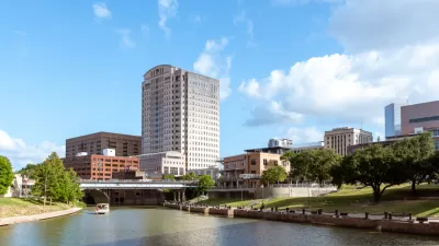
The North Houston Highway Improvement Project (NHHIP, popularly referred to as "the I-45 project," has been in the works for 15 years, with the intention "[tackling] mobility problems all the way from North Houston to Midtown, south of downtown." Fulton explains the scope of the project in more detail:
On the North Side, TxDOT will widen I-45 to accommodate high-occupancy vehicle lanes and will likely expand the frontage road on both sides.
Through Downtown, the project would re-route I-45 alongside I-69 (the former Highway 59) to the east of the George R. Brown Convention Center (GRB) and decommission, if not remove, the Pierce Elevated, thus reconnecting Downtown and Midtown. A seven-block “cap” will cover the freeway behind the GRB, creating the possibility of a park that reconnects Downtown to EaDo. South of Downtown, TxDOT will change I-69 from elevated to depressed, connecting it to the depressed I-69 freeway through Montrose and several small caps will be constructed over the freeway near Main Street. Proposed plans can be seen in the video below.
The Rice Kinder Institute for Urban Research published Fulton's article on its blog, Urban Edge, as a first in a series of articles that will give experts a chance to weight in on the implications of the project for the city of Houston.
The second article in the series was written by Bob Eury, and describes the projects as a "once-in-a-lifetime" opportunity.
FULL STORY: Experts to share what TxDOT's I-45 project means for Houston

Proposed Park Yet Another Hurdle for Houston Interstate Expansion
The Interstate 45 widening project, halted by a federal order and opposed by many local officials and organizations, could hit a new snag if White Oak Bayou becomes a city park.
A Freeway Rebellion Rises in the Unlikeliest of States: Texas
“There’s no train, there’s no bus, there’s no anything that supports mass transportation. It doesn’t exist.” -Houston resident Fabian Ramirez.
Contentious Houston Freeway Widening Project Inches Forward
Federal officials have given TxDOT the go-ahead to resume work on a small portion of a controversial interstate widening project in downtown Houston.

Planetizen Federal Action Tracker
A weekly monitor of how Trump’s orders and actions are impacting planners and planning in America.

Chicago’s Ghost Rails
Just beneath the surface of the modern city lie the remnants of its expansive early 20th-century streetcar system.

San Antonio and Austin are Fusing Into one Massive Megaregion
The region spanning the two central Texas cities is growing fast, posing challenges for local infrastructure and water supplies.

Since Zion's Shuttles Went Electric “The Smog is Gone”
Visitors to Zion National Park can enjoy the canyon via the nation’s first fully electric park shuttle system.

Trump Distributing DOT Safety Funds at 1/10 Rate of Biden
Funds for Safe Streets and other transportation safety and equity programs are being held up by administrative reviews and conflicts with the Trump administration’s priorities.

German Cities Subsidize Taxis for Women Amid Wave of Violence
Free or low-cost taxi rides can help women navigate cities more safely, but critics say the programs don't address the root causes of violence against women.
Urban Design for Planners 1: Software Tools
This six-course series explores essential urban design concepts using open source software and equips planners with the tools they need to participate fully in the urban design process.
Planning for Universal Design
Learn the tools for implementing Universal Design in planning regulations.
planning NEXT
Appalachian Highlands Housing Partners
Mpact (founded as Rail~Volution)
City of Camden Redevelopment Agency
City of Astoria
City of Portland
City of Laramie