


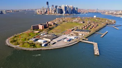
The island's 40-acre park is a recreational destination, but waterfront advocates would like to see more use of Governor Island's shoreline and maritime infrastructure.
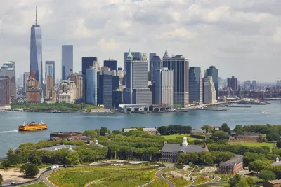
The Waterfront Alliance has released a new plan for Governors Island in New York, with a focus on the island’s 2.2 miles of coastline, reports Daniel Geiger:
Among the alliance's ideas are to create more places for visitors to explore the water, including by allowing access to a natural sand beach along Buttermilk Channel, which flows between the island and Brooklyn. A marina could be built to encourage recreational boaters to visit. Reorganizing the island's six working piers and boat landings could create more space for bigger vessels with scientific or historic value to dock.
Additional recommendations include increased ferry service between the island and various boroughs and separation of freight and garbage transport from ferry service. "The alliance wasn’t able to immediately say what its recommendations could cost to implement. Redeveloping piers to accommodate garbage and freight transfers and large visiting ships can run into the many millions of dollars," writes Geiger.
FULL STORY: Waterfront advocates set sights on Governors Island


Rezoning for Governors Island Approved
A mix of new development focused on future needs and new tools for preservation are included in the rezoning package for the south end of Governors Island approved by the New York City Council in May.
Massive Climate Research Center Planned for Governors Island, Rezoning Now Included
A speculative but exceedingly ambitious plan is pressing for air time in New York City.

Aging New York City Parks in Desperate Need of Repairs
The city’s parks are facing a crisis on the horizon resulting from a lack of maintenance and growing capital improvement needs.

Maui's Vacation Rental Debate Turns Ugly
Verbal attacks, misinformation campaigns and fistfights plague a high-stakes debate to convert thousands of vacation rentals into long-term housing.

Planetizen Federal Action Tracker
A weekly monitor of how Trump’s orders and actions are impacting planners and planning in America.

In Urban Planning, AI Prompting Could be the New Design Thinking
Creativity has long been key to great urban design. What if we see AI as our new creative partner?

King County Supportive Housing Program Offers Hope for Unhoused Residents
The county is taking a ‘Housing First’ approach that prioritizes getting people into housing, then offering wraparound supportive services.

Researchers Use AI to Get Clearer Picture of US Housing
Analysts are using artificial intelligence to supercharge their research by allowing them to comb through data faster. Though these AI tools can be error prone, they save time and housing researchers are optimistic about the future.

Making Shared Micromobility More Inclusive
Cities and shared mobility system operators can do more to include people with disabilities in planning and operations, per a new report.
Urban Design for Planners 1: Software Tools
This six-course series explores essential urban design concepts using open source software and equips planners with the tools they need to participate fully in the urban design process.
Planning for Universal Design
Learn the tools for implementing Universal Design in planning regulations.
planning NEXT
Appalachian Highlands Housing Partners
Mpact (founded as Rail~Volution)
City of Camden Redevelopment Agency
City of Astoria
City of Portland
City of Laramie