Sidewalk Labs, a smart cities shop within the Alphabet corporate structure, is working to revolutionize technology's role in city planning. Sidewalk Labs recently released the street design principles it's using to guide that effort.



"Sidewalk Labs, the smart cities arm of Google parent company Alphabet, has released a set of design principles to make streets safer and more efficient as new mobility technologies come online," reports Jason Plautz.
Willa Ng laid out the four principles in a blog post posted on Medium. According to Ng, Sidewalk Labs is attempting to push the current era of critical thinking about streets (in the era of building political support for complete streets and the dawn of autonomous vehicles).
Here are the four principles Sidewalk Labs is using to guide street designs:
- Principle 1: Tailor streets for different modes.
- Principle 2: Separate streets by speed.
- Principle 3: Incorporate flexibility into street space.
- Principle 4: Recapture street space for the public realm, transit, bikes, and pedestrians.
As noted by Plautz, Sidewalk Labs will get a chance to test its principles with the Quayside development, moving forward in Toronto despite controversy. There's also a full report on the design principles.
Read the full story: Sidewalk Labs releases street design principles

Autonomous Vehicles and Streets: A Guide to Potential Impacts
As the arrival of autonomous vehicles (AVs) becomes more of a reality, cities need to start considering how this new technology will affect streets and street networks. This brief guide provides an overview and resources on this topic.
NHTSA Cuts Could Make Roads More Dangerous
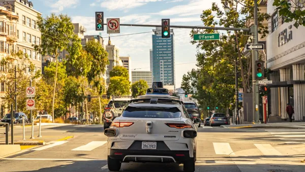
The agency is losing almost half of the team that oversees autonomous vehicle safety, among dozens of other key personnel.

US Street Design Manual Inches Toward Safer Roads
The guiding document for U.S. road design is starting to recognize the needs of people walking and biking, but safe streets advocates say more significant changes are needed to reduce the high number of pedestrian deaths and improve connectivity for all road users.

Planetizen Federal Action Tracker
A weekly monitor of how Trump’s orders and actions are impacting planners and planning in America.

The state-sanctioned urbicide of Austin
People don’t kill cities. Freeways do.

US to reduce Colorado River water deliveries to Mexico
A new Colorado Treaty amendment reduces Mexico’s Colorado River water allocation by 250,000 acre feet.

Nation's most wind-powered state turns to coal as data centers increase energy demand
For the first time in decades, Iowa has increased its generation of coal power.

NYC cools commuters with city's first rain garden above a bus stop
New York City officials say the plants in the rain garden can absorb 16 gallons of rainwater during heavy storms.

Brightline West’s future may rely on $6 billion federal loan
The company has until Nov. 2 to make a $400 million equity investment into its proposed high-speed rail line.

FREE Course: Walkable City 1: Why Walkability?
After describing his path towards focusing on walkability as the essence of good planning, Jeff Speck marches through his five principal reasons for making more walkable places.
Reinventing Malls: Planning Alchemy—Turning Gray Fields Into Gold
The course focuses on the opportunities and imperatives that shape reinvention of mall sites.

Eagle County Government
Harvard University Graduate School of Design
Nashville Planning Department
The Architects Foundation
University of Cincinnati Online
The Pocatello Development Authority
The Urban Renewal Agency of the City of Pocatello
Journal of the American Planning Association