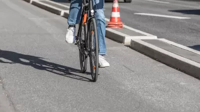
Several strategies and initiatives seek to make parks more accessible on foot in the county of Los Angeles. Clement Lau, an L.A. County planner, summarizes a few of these strategies and initiatives.
Los Angeles County is employing a multi-pronged effort to make its parks more accessible. L.A. County planner Clement Lau writes about these efforts. Most of these efforts or initiatives have neither originated nor are limited to L.A. County. They are intended to apply everywhere they are needed in the Country. Under a half-mile from residence to park has become the standard for an adequate number and dispersion of parks. However, distance isn’t the only barrier to parks. Other barriers include lack of sidewalks and bike lanes, speeding vehicles, crime, and other things that can make a walk or bike ride to a park feel unsafe or unpleasant.
- Safe Routes to Parks – A joint effort of the National Recreation and Park Association (NRPA) and the Safe Routes to School National Partnership to provide evidence-based best practices to create safe access to parks.
- 10-Minute Walk Campaign – A joint effort of the aforementioned NRPA, the Trust for Public Land (TPL), and the Urban Land Institute (ULI) to promote the development of parks within a 10 minute walk of all residences. The initiative provides grants and technical assistance to support planning efforts that further the 10-minute walk goal. It has also created a useful and widely used park planning tool called ParkServe.
- Step by Step Pedestrian Plan – A plan developed by the LA County Dept. of Public Health is a "tailored approach" to pedestrian planning by involving residents, businesses, and other stakeholders to meet community needs.
- Vision Zero Action Plan – LA County, like many other municipal and regional governments, has its own "vision zero" plan. While the term has become somewhat overused, LA County’s VZ Plan prioritizes the obvious but rarely adequately implemented approach that involves "acknowledging that people make mistakes."
For a more detailed description of the these initiatives, as well as links to the programs, please refer to the source article.
FULL STORY: A Walk to the Park

Maui's Vacation Rental Debate Turns Ugly
Verbal attacks, misinformation campaigns and fistfights plague a high-stakes debate to convert thousands of vacation rentals into long-term housing.

Planetizen Federal Action Tracker
A weekly monitor of how Trump’s orders and actions are impacting planners and planning in America.

In Urban Planning, AI Prompting Could be the New Design Thinking
Creativity has long been key to great urban design. What if we see AI as our new creative partner?

King County Supportive Housing Program Offers Hope for Unhoused Residents
The county is taking a ‘Housing First’ approach that prioritizes getting people into housing, then offering wraparound supportive services.

Researchers Use AI to Get Clearer Picture of US Housing
Analysts are using artificial intelligence to supercharge their research by allowing them to comb through data faster. Though these AI tools can be error prone, they save time and housing researchers are optimistic about the future.

Making Shared Micromobility More Inclusive
Cities and shared mobility system operators can do more to include people with disabilities in planning and operations, per a new report.
Urban Design for Planners 1: Software Tools
This six-course series explores essential urban design concepts using open source software and equips planners with the tools they need to participate fully in the urban design process.
Planning for Universal Design
Learn the tools for implementing Universal Design in planning regulations.
planning NEXT
Appalachian Highlands Housing Partners
Mpact (founded as Rail~Volution)
City of Camden Redevelopment Agency
City of Astoria
City of Portland
City of Laramie


