


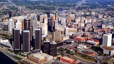
Detroit will soon join the ranks of cities that have ripped out high-speed freeways from their urban core.

"After years of study and debate, the Michigan Department of Transportation is moving ahead with plans to rip out Detroit's I-375 expressway and restore a surface street there," reports John Gallagher.
"I-375 runs south from I-75 along the east side of downtown," adds Gallagher. "The creation of I-75 and I-375 a half-century ago destroyed the historic African-American neighborhood known as Black Bottom, an episode that remains a painful memory for many older black Detroiters."
The decision to remove I-375 began with discussions that began in 2013, also reported by John Gallagher and picked up by Planetizen at the time. MDOT is unlikely to start ripping pavement out until 2022, and the whole project is still dependent on funding and planning details. The article includes a rendering of the pedestrian sidewalks, bike lanes, and landscaped public space that will replace I-375 for a mile near the Detroit waterfront and some of its most iconic Downtown buildings.
FULL STORY: MDOT moving ahead with plan to rip out I-375 freeway, restore surface street


Can Detroit's Urban Revitalization Undo the Mistakes of Urban Renewal?
Some experts think the language used to describe a redevelopment project in Detroit might be overly ambitious.
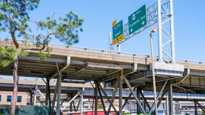
Detroit Considers Highway Removal to Help Its Downtown Revival
By exploring whether to turn I-375 into a surface street, the city that is the United States' foremost exemplar of suburban flight is considering a historic reversal that would demonstrate its optimism in its recovering downtown.
‘Reconnecting Communities’ Could Fund Highway Expansions
Applications to the program reveal a pattern of state agencies requesting funds for projects that perpetuate car-centric development with only nominal equity components.

Maui's Vacation Rental Debate Turns Ugly
Verbal attacks, misinformation campaigns and fistfights plague a high-stakes debate to convert thousands of vacation rentals into long-term housing.

Planetizen Federal Action Tracker
A weekly monitor of how Trump’s orders and actions are impacting planners and planning in America.

Chicago’s Ghost Rails
Just beneath the surface of the modern city lie the remnants of its expansive early 20th-century streetcar system.

Bend, Oregon Zoning Reforms Prioritize Small-Scale Housing
The city altered its zoning code to allow multi-family housing and eliminated parking mandates citywide.

Amtrak Cutting Jobs, Funding to High-Speed Rail
The agency plans to cut 10 percent of its workforce and has confirmed it will not fund new high-speed rail projects.

LA Denies Basic Services to Unhoused Residents
The city has repeatedly failed to respond to requests for trash pickup at encampment sites, and eliminated a program that provided mobile showers and toilets.
Urban Design for Planners 1: Software Tools
This six-course series explores essential urban design concepts using open source software and equips planners with the tools they need to participate fully in the urban design process.
Planning for Universal Design
Learn the tools for implementing Universal Design in planning regulations.
planning NEXT
Appalachian Highlands Housing Partners
Mpact (founded as Rail~Volution)
City of Camden Redevelopment Agency
City of Astoria
City of Portland
City of Laramie