


"Smart city" plans are being announced at a steady clip. The latest master planned "smart city" proposal comes for a former U.S. Navy-owned site near Boston.
"Architecture firms Elkus Manfredi and Sasaki have unveiled a masterplan to transform a parcel of land south of Boston into a smart city," according to an article by Eleanor Gibson.
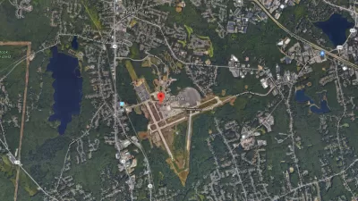
The 1,500-acre site is the former home of a U.S. Navy airfield. "Developer LStar Ventures acquired the site – approximately 1,500 acres (607 hectares) – two years ago, with the ambition to build a new community 'from the ground up'," according to Gibson.
Union Point, as the master planned development is named, "will incorporate high-tech features such as autonomous vehicles, and smart systems for collecting and sharing data, to improve the lifestyles of future residents and the management of the city," explains Gibson. More details, and renderings, are included in the original article.
Union Point joins a smart city landscape that has populated quickly in recent months. In October, Toronto announced a plan to partner with Sidewalk Labs (a unit of Google's parent company) to develop the Quayside district into a smart cities experiment. News also broke in November that Bill Gates had acquired 25,000 acres of land located outside of Phoenix to develop a smart city dubbed Belmont.
FULL STORY: Smart city planned for former US Navy airfield near Boston


Waterfront Toronto Greenlights Most of Sidewalk Labs' Quayside Master Plan
An evaluation committee made up of Waterfront Toronto staff has given a green light for the Sidewalk Labs master plan for Toronto to proceed to the next stages of planning.
Master Plan for Quayside 'Smart City' Released by Sidewalk Labs and Waterfront Toronto
The long-awaited master plan for Quayside in Toronto was released to the public today.
The Planned Community of the Future Is Also a 'Smart City'
Planned community developer LStar Ventures is building a smart city experiment near Boston.

Maui's Vacation Rental Debate Turns Ugly
Verbal attacks, misinformation campaigns and fistfights plague a high-stakes debate to convert thousands of vacation rentals into long-term housing.

Planetizen Federal Action Tracker
A weekly monitor of how Trump’s orders and actions are impacting planners and planning in America.

In Urban Planning, AI Prompting Could be the New Design Thinking
Creativity has long been key to great urban design. What if we see AI as our new creative partner?

King County Supportive Housing Program Offers Hope for Unhoused Residents
The county is taking a ‘Housing First’ approach that prioritizes getting people into housing, then offering wraparound supportive services.

Researchers Use AI to Get Clearer Picture of US Housing
Analysts are using artificial intelligence to supercharge their research by allowing them to comb through data faster. Though these AI tools can be error prone, they save time and housing researchers are optimistic about the future.

Making Shared Micromobility More Inclusive
Cities and shared mobility system operators can do more to include people with disabilities in planning and operations, per a new report.
Urban Design for Planners 1: Software Tools
This six-course series explores essential urban design concepts using open source software and equips planners with the tools they need to participate fully in the urban design process.
Planning for Universal Design
Learn the tools for implementing Universal Design in planning regulations.
planning NEXT
Appalachian Highlands Housing Partners
Mpact (founded as Rail~Volution)
City of Camden Redevelopment Agency
City of Astoria
City of Portland
City of Laramie