


Hoping a concrete diagnosis of the problem will help Maryland solve its food desert problem, John Hopkins Center for a Livable Future has built a map of the areas most in need of fresh groceries.
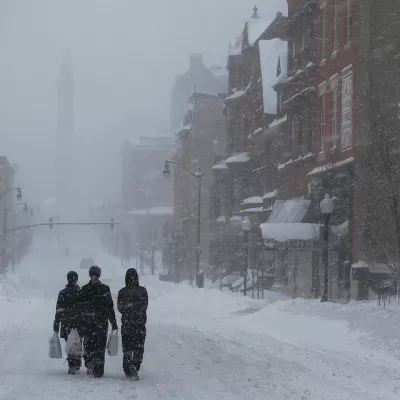
"About 25 percent of Baltimoreans live in city-designated “food deserts," areas at least a quarter of a mile from a grocery store, where median income is low and many residents lack access to a vehicle," Natalie Delgadillo reports for Governing. The problem is not unfamiliar to people and officials in the in the city, but it was a hard thing to quantify, as there weren’t comprehensive statistics around food deserts. "That's starting to change with the help of a mapping tool from the Johns Hopkins Center for a Livable Future (CLF)," Natalie Delgadillo writes for Governing.
The CLF site Maryland Food System Map collects and maps food access in Baltimore and across the state(LINK). Holy Freishtat, Baltimore's Food Policy Director, told Delgadillo the maps are already affecting policy, including, "HB 1492, a bill signed by the Governor in May, authorizes the Department of Housing and Community Development to make small loans to food desert projects in the state," Delgadillo writes
FULL STORY: Food Deserts and the Policy Power of Maps

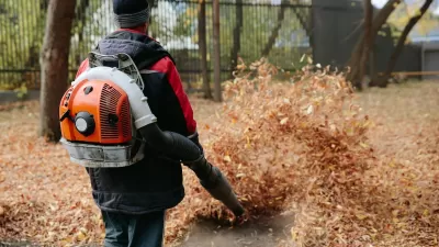
Baltimore Bans Gas Leafblowers
The devices release as much air pollution as driving 1,100 miles and have been banned in over 100 U.S. cities.

Even in ‘Food Deserts,’ Independent Grocers Struggle to Survive
Government support has helped open stores in underserved communities, but cost and scale make it difficult for small businesses to survive long-term.
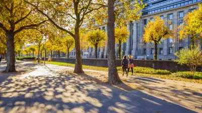
How Urban Design Impacts Public Health
With more and more people living in cities, designing equitably healthy urban spaces becomes a key question for policymakers.

Maui's Vacation Rental Debate Turns Ugly
Verbal attacks, misinformation campaigns and fistfights plague a high-stakes debate to convert thousands of vacation rentals into long-term housing.

Planetizen Federal Action Tracker
A weekly monitor of how Trump’s orders and actions are impacting planners and planning in America.

In Urban Planning, AI Prompting Could be the New Design Thinking
Creativity has long been key to great urban design. What if we see AI as our new creative partner?

How Trump's HUD Budget Proposal Would Harm Homelessness Response
Experts say the change to the HUD budget would make it more difficult to identify people who are homeless and connect them with services, and to prevent homelessness.

The Vast Potential of the Right-of-Way
One writer argues that the space between two building faces is the most important element of the built environment.

Florida Seniors Face Rising Homelessness Risk
High housing costs are pushing more seniors, many of them on a fixed income, into homelessness.
Urban Design for Planners 1: Software Tools
This six-course series explores essential urban design concepts using open source software and equips planners with the tools they need to participate fully in the urban design process.
Planning for Universal Design
Learn the tools for implementing Universal Design in planning regulations.
Gallatin County Department of Planning & Community Development
Heyer Gruel & Associates PA
JM Goldson LLC
City of Camden Redevelopment Agency
City of Astoria
Transportation Research & Education Center (TREC) at Portland State University
Jefferson Parish Government
Camden Redevelopment Agency
City of Claremont