


We have compiled a list of mobile apps to support planning, as part of our annual update. Learn about exciting new ways to explore cities and enhance planning via mobile apps. Please feel free to add your own favorites.

Each year Brittany Kubinski and I provide an update on mobile application. A mobile app is an application software designed to run on smartphones, tablet computers and other mobile devices. Mobile applications (apps) have the possibility to enhance public participation in local governance and planning, as well as the ability to improve efficiency and data collection for planners.We annually survey a cross-section of planners to understand their app use habits, and in doing so developed a comprehensive list of the most effective mobile apps for planners. During December of 2013 we surveyed planners on their use of mobile apps in the planning profession. We asked planners what types of mobile apps they are currently using, what apps they would like to see developed in the future, and what mobile apps they themselves are working on developing.
We heard from 237 planners from across the United States. The majority of respondents (38%) hailed from the Northeast/Atlantic, and about 26% and 13% in the Midwest and Southern regions, respectively. Most participants responded that they work in the public sector and 33% have been working in the planning profession for more than 20 years. Of the planners surveyed, 91% either own a smartphone or plan to purchase one in the future. Planners who responded that they own a smartphone were asked about various types of apps that they might use and the frequency of their use. Results are shown in the chart below.

From the survey we found similar results as to usage of apps as compared to last year. We again found that the most commonly used apps by planners in their daily lives are social media apps, like Twitter and Facebook. Note taking apps are also popular for daily use; and apps like Photoshop, PowerPoint and Prezi, that are used for productivity and for giving presentations, are more frequently used on a monthly basis.
In the survey we also sought to understand how planners are using smartphones and mobile apps at work. Eighty-two percent of those surveyed use their smartphone for work purposes, while 42 percent are using tablets at work, both increases over the previous years survey.
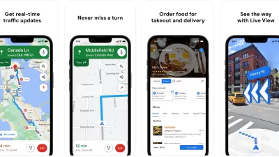
One of the primary goals of our survey was to identify apps that planners are currently using or developing to support their work. Planners mentioned common apps such as Google Maps, Dropbox, ArcGIS, GoToMeeting, and SlideShark, among others. Here are four apps planners told us about that we find to be particularly interesting.
- PhotoToaster: Allows you to edit pictures quickly for use in social media (iOS)
- Art Rage: Allows for realitistic painting and sketching (iOS)
- Phases of the Moon: Allows you to see the phase of the moon so you can plan your public meetings anticipating citizen behavior (don’t schedule your public meetings for a full moon) (iOS and Android)
- Android Time Card: for tracking billable hours (Android)
In the survey, planners were asked whether or not their organization has created an app or discussed creating an app. Fifteen percent responded that their organization has or is creating an app, and 29 percent responded that their organization is discussing creating an app in the future. Below are five of the apps created to support cities and their planning:
- MetroPulse: This app, developed for the Chicago Metropolitan Agency for Planning, allows users to search, visualize and analyze more than 200 socioeconomic indicators about communities in the Chicago Metropolitan Area (iOS)
- Bulky Basics: This app, developed as part of an apps for Amsterdam contest, provides information on days and times bulk waste is picked up, nearby recycling facilities, and rules for bulk disposal (iOS)
- SurviveSD: This app, created as part of the San Diego apps challenge, provides emergency preparedness information including a flashlight function, list of emergency supplies, police scanner feeds, and links to local response services (iOS)
- Housing Discrimination Compaint Application: This HUD app allows people to learn about fair housing and submit complaints (iOS)
- Dwellr: This Census Bureau app allows you to see neighborhood level statistics and explores the best cities for you to find your dream neighborhood (Android and iOS)
And of course there are many apps out there that are related to planning. These are a some of the apps that we found to be interesting for planners:
- SmartSantanderRA: Augmented reality app provides information about 2,700 locations in the city of Santander and real time information about city services. The City's Pace of the City app allows citizens to volunteer environmental data from their smartphone (Android and iOS)
- LayAR: Within the LayAR augmented reality app another app PlanAR superimposes information from the City of Oslo, Norway’s Urban Development Department, for example telling you that the apartment building added new balconies in 2010 when you point the phone at the building. Visit the Oslo School of Architecture and Design for more info. (Android and iOS)
- Citymapper: Provides information on time by mode and number of calories that will be burned to get from one destination to another in New York and London (Android and iOS)
- REgis Void: Identifies retailers who are likely to be willing to locate in a particular area (iOS)
- Environmental Impact Calculator: Estimates a building's carbon footprint (iOS)
- Stereopublic: Identifies the quietest public spaces in cities (iOS)
- Phantom City: Explores designs for cities created by architects and artists over time based on the location in a city (iOS)
- MetroNap: Allows you to nap on New York subway and it will awake you before reaching your destination (Android)
- Parker: Shows real-time parking availability and prices (Android and iOS)
- Urban World: Allows for comparing data about more than 2,600 cities across the globe (iOS)
- 1AM Mobile: A community based photo app that captures community art in communities (iOS)
- Boskoi: Explore and map edible landscapes wherever you are (Android)
- RideScout: Provides real time transportation options on getting from one place to another (Android and iOS)
- JetPac City Guide: Measures the happiness of cities based on public instagram photos, sharing real pictures taken at locations throughout cities (iOS)
- Mappiness: Maps the happiness levels across the United Kingdom (Android)
- Megapolis: A video game that allows you to build your own city (Android)
- AllTrails: Discover outdoor hiking trails and share your adventures with others (Androis and iOS)
- Evzdrop: Allows you to see what is happening at locations in real time (Android)
- Widenoise: Captures noise levels and displays them on an interactive map. Allows users to check the average sound level of a neighborhood (Android and iOS)
- Re:route: Allows users to earn points for walking or bicycling in London. Points can be redeemed for rewards such as haircuts, hotels, and shops (iOS)
- Blindsquare: This app assists the blind and visually impaired by pulling up information about the surroundings on FourSquare and Open Street Map. It speaks the most useful information. (iOS)
- ESRI BAO: Access demographic and market information across the United States (Android and iOS)
- BikeMap: Includes 900,000 bike routes worldwide and tracks your route as you ride (Android, iOS, Windows Phone)
- Railbandit: Displays information on upcoming trains on light rails systems in the US and Canada (Blackberry)
- Panorama 360 Cities: Share and view 360 panoramic images from cities around the world (iOS)
- Wikihood: Take virtual city tours and explore what is around you (Android and iOS)
- Co-Cities: Shares your driving data with European cities and gives the user information on transportation routes (Android and iOS)
- Sidecar: Lets car owners rent their car out to others or find a car available for rent in their neighborhood (Android and iOS)
There are a couple of great apps that provide very useful mobile services. These require paid subscriptions for services.
- Traffic Duco: Collects traffic data, such as turning movements, pedestrian counts, trips generated. Can be used by multiple people on the same project (Android and iOS) (Note a free 30 day trial is available)
- Local Data: Allows communities to develop information gathering and surveying tools that can be deployed via mobile device.
There are certainly a lot more apps that are useful to planners. You can learn about other apps for planners by reviewing last year’s app update on Planetizen, Cyburbia’s list of apps planners need, and a study done at the University of Cincinnati including a list of 34 apps that can be used in the field of planning. If you have apps that should be added to our growing list for 2014, please let me know. I also regularly tweet about new apps that I learn about @EvansCowley.

There's a Planning App for That
For my annual update of the apps that support planning I've compiled a list of the latest applications for sharing information, visualizations, sensing, predicting, supporting decision making, crowdsourcing, and engaging.
Recommended Mobile Apps for Urban Planning in 2023
Planetizen's annual list of top apps for planners is back, ten years after its first appearance on the site. Scores of apps have been recommended by planners as examples of planning in action, or tools for planning action.
Best Apps for Urban Planning in 2022
Mobile apps continue to redefine the practices of planning—urban planning, regional planning, transportation planning, community planning, and rural planning included.

Planetizen Federal Action Tracker
A weekly monitor of how Trump’s orders and actions are impacting planners and planning in America.

Chicago’s Ghost Rails
Just beneath the surface of the modern city lie the remnants of its expansive early 20th-century streetcar system.

San Antonio and Austin are Fusing Into one Massive Megaregion
The region spanning the two central Texas cities is growing fast, posing challenges for local infrastructure and water supplies.

Since Zion's Shuttles Went Electric “The Smog is Gone”
Visitors to Zion National Park can enjoy the canyon via the nation’s first fully electric park shuttle system.

Trump Distributing DOT Safety Funds at 1/10 Rate of Biden
Funds for Safe Streets and other transportation safety and equity programs are being held up by administrative reviews and conflicts with the Trump administration’s priorities.

German Cities Subsidize Taxis for Women Amid Wave of Violence
Free or low-cost taxi rides can help women navigate cities more safely, but critics say the programs don't address the root causes of violence against women.
Urban Design for Planners 1: Software Tools
This six-course series explores essential urban design concepts using open source software and equips planners with the tools they need to participate fully in the urban design process.
Planning for Universal Design
Learn the tools for implementing Universal Design in planning regulations.
planning NEXT
Appalachian Highlands Housing Partners
Mpact (founded as Rail~Volution)
City of Camden Redevelopment Agency
City of Astoria
City of Portland
City of Laramie