Over the past decade, pedestrian and auto collisions have become more lethal for pedestrians. Could this be caused by carless households moving to pedestrian-hostile places?



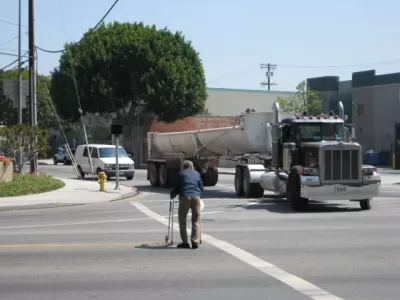
A couple of weeks ago, I reviewed Angie Schmitt’s book, about the recent increase in American pedestrian fatalities caused by automobiles. I mentioned that one possible cause of this problem might be that people without cars might be moving to places that are more dangerous for walking—that is, automobile-oriented Sunbelt cities and suburbs with wide roads and lots of high-speed traffic.
If this “Moving to Danger” theory is correct, places with high (and rising) pedestrian death rates would also be places where the number of carless residents has increased over the past decade or so. As it happens, the National Highway Traffic Safety Administration (NHTSA) has issued a brief research note on pedestrian deaths in major counties and metropolitan areas, so I now know a bit more about the geography of car-induced death.
The NHTSA document shows that among metros with over 44 auto-induced pedestrian fatalities, nine have over 2.5 such deaths per 100,000 people—Miami/Fort Lauderdale, Riverside/San Berardino, Phoenix, Tampa, Orlando, San Diego, Orlando, Las Vegas, Memphis, and Jacksonville. However, not all of these regions have become more dangerous. In four of these metros (Memphis, Miami, Riverside, Phoenix), pedestrian fatalities rose by over 30 percent between 2014 and 2018. If the “Moving to Death” theory was correct, we would find that the number of households without cars increased in those metros in recent years.
American Community Survey (ACS) data shows that during this period, the number of carless households in Memphis decreased, but by an insignificant margin—from 39,012 to 38,342- less than the ACS margin of error. In Miami, the number of carless households decreased by an insignificant margin—from 170,365 to 169.704. In Riverside, the number of carless households dramatically decreased, from 70,377 to 53,023. In Phoenix, the number of carless households decreased from 104,562 to 97,649. In other words, the number of carless households decreased in all four metro areas- sometimes by a possibly-significant amount, sometimes by an insignificant amount.*
In three other high-fatality metros (San Diego, Orlando, Las Vegas) fatalities rose by between 20 and 30 percent. Here the household data is more ambiguous. Between 2014 and 2018 the number of carless households decreased by less than 1000 people in Orlando, and increased by less than 1000 people in San Diego and Las Vegas. Since the ACS tables state that the margin of error for its surveys on this point is a few thousand people, these changes are not statistically significant. Thus, it appears that the number of carless households did not increase in these high-fatality metros either.
It could be argued that even if carless households have not been moving to high-fatality metros, high rents have forced them to high-fatality suburbs within a metro. The NHTSA note does not have municipality-by-municipality data**—but it does have data for some of our nation’s larger counties, including suburban counties. In particular, it includes arguably useful data for three metros: Los Angeles, Miami, and New York.
In Los Angeles, the brief includes data for (more urban) Los Angeles County and (more suburban) Riverside and Orange County.*** Between 2014 and 2018, pedestrian deaths increased by 8 percent in Los Angeles, 27 percent in Orange, and 38 percent in Riverside. If the “Moving to Danger” hypothesis was correct, the number of carless households would have increased in Orange and Riverside. But in Riverside, the number of carless households decreased by an arguably significant amount: from just over 38,000 in 2011 to 34,269 in 2014 to 26,670 in 2018. In Orange the pattern is more complicated: the number of carless households decreased from 50,681 in 2011 to 44,200 in 2014, and then increased to 45,991 in 2018. Although there was an increase in the number of carless households in Orange County after 2014, this increase is not significant, since according to the Census Bureau the margin of error was plus or minus 3411. By contrast, the decrease in carlessness in Riverside was much more significant. Thus, it appears likely that there are fewer carless households in the Los Angeles suburbs in 2018 than there were in 2011 or 2014.
In south Florida, the brief includes data for (somewhat urban) Miami-Dade and two more suburban counties, Broward and Palm Beach. In Florida, pedestrian fatalities actually increased more rapidly in the more urban county: by 46 percent in Miami-Dade, as opposed to 24 percent in Broward, and 14 percent in Palm Beach. Moreover, the number of carless households decreased very slightly in both suburban counties: in Broward, from 48,544 in 2014 to 46,999 in 2018, and in Palm Beach, from 34,623 in 2014 to 33,623 in 2018. So South Florida also provides zero support for the “Moving to Danger” hypothesis.
In New York, I have data for three New York City boroughs (Manhattan, Bronx and Queens) and two suburban counties (Nassau and Suffolk). Between 2014 and 2018, pedestrian deaths decreased in three of the counties, increased by 8 percent in Queens, and increased by 29 percent in Suffolk County. If the “Moving to Danger” hypothesis was correct, the number of carless households would have increased in Queens and Suffolk. But no such increase occurred: instead, the number of carless households actually went down between 2014 and 2018, though by statistically insignificant margins (from 296,200 to 293,311 in Queens, and from 27,051 to 26,375 in Suffolk).
Because I looked at an extremely small number of counties and metro areas, I cannot say that I have conclusively disproved the “Moving to Danger” hypothesis. But certainly, I have found no support for it.
*I note that my methodology doesn’t account for households where there are fewer cars than adults; I know of no way to fix this problem based on ACS data. Also, since four years is not a long time, I also looked at ACS carless-household data for 2011, which shows results roughly similar to the 2014 data.
**And even if it did, such data would be unreliable, since many suburbs are so small that they might have only one or two pedestrian fatalities per year.
***It also includes data for San Bernardino County—but pedestrian fatalities did not materially increase there, so it does not seem relevant to this particular argument.

What Walk Buttons Do (and Don't Do)
Are pedestrian walk buttons effective, or do they only give us the illusion of control? It can vary.

The Future of the American Auto Industry: Not Cars
The American passenger vehicle fleet is being transformed into bigger, fuel-thirstier, and more dangerous models (for those hit by them). Americans have shown a preference for light trucks, and manufacturers are responding by ditching cars.
Hawaii DOT takes action after reporters call attention to dangerous crosswalk
The state made changes to a treacherous intersection after reporting revealed that traffic light timing was posting a threat to pedestrians.

Planetizen Federal Action Tracker
A weekly monitor of how Trump’s orders and actions are impacting planners and planning in America.
Data reveals that NYC’s bet on congestion pricing has paid off
After almost two years of the program, reports show positive impacts on traffic and air quality and no disruptions to parking.

HUD modernizes 50-year-old manufactured housing framework
The Next Generation Manufactured Housing Action Plan establishes new energy-efficiency standards for manufactured homes, and new guidelines for anchoring them.

Florida could lose billions in funding for infrastructure, parks
If Amendment 3 passes, Miami-Dade would lose about $445 million annually by fiscal year 2028-29.

New Mexico spent millions drafting climate goals. Data centers are unraveling them
Three data centers in New Mexico and El Paso will release more emissions yearly than 2 million cars in the same timeframe.

This Ohio town is using AI to speed up transit analysis
The Greater Dayton Regional Transit Authority’s new AI tool correctly determined riders’ preferred ways to reach key commuter routes.

FREE Course: Walkable City 1: Why Walkability?
After describing his path towards focusing on walkability as the essence of good planning, Jeff Speck marches through his five principal reasons for making more walkable places.
Reinventing Malls: Planning Alchemy—Turning Gray Fields Into Gold
The course focuses on the opportunities and imperatives that shape reinvention of mall sites.

Rutgers University, Edward J. Bloustein School of Planning and Public Policy
One Hundred Miles
County of Mendocino
The Architects Foundation
University of Cincinnati Online
Montrose County
Northern Illinois Transit Authority (NITA)
The Pocatello Development Authority

