Technology
Tactical Urbanism: A Look Back at 2012
From guerrilla wayfinding to future-tising, these are my top five, perhaps lesser known, highlights of a banner year for Tactical Urbanism.
An Urban Tech Wish List
What do you get for the smart city that thinks it has everything? Lauren Drell lists the 25 technologies every smart city should have.
'App Breakthrough' Benefits NYC Straphangers
Friday marked a milestone in the effort to bridge the gap between NYC's century-old subway system and emerging technologies; "a leap forward for a service that has lagged behind its peers both at home and abroad in adopting new technologies."
Historic Homes Are Losing Visitors, But Perhaps There’s An App for That
Of the thousands of historic homes across the country, many are seeing steep declines in visitors, reports J. Freedom du Lac. Consolidation and new technologies, such as smartphone apps, may be the best alternatives to closing doors.
New Center Seeks to Take the Guesswork out of Planning
Researchers at the University of Chicago are tackling a problem that is confronting the globe's biggest cities: how to turn the reams of data being collected and opened to the public and turn it into actionable information for decision-makers.
'Smart Screens' to Provide City Data in New York
Can 250 high-def, touch-screen kiosks make New York City more user-friendly, personalized and safe?
How Smart Is Smart Parking - And For Whom?
Parking enforcers, not motorists in search of available parking, may be the main beneficiaries of 'smart parking' technology as they have the ability to immediately spot parking spaces where vehicles have overstayed their time limits and by how long.
Biometric Monitors: Coming to a Driveway Near You
Might your car one day serve as a mobile doctor's office? If research into biometric monitoring being conducted by carmakers comes to fruition, your car may soon be able to tracks your stress and blood sugar levels, and more, reports Bob Moon.
Art Meets Infrastructure in an L.A. Suburb
The design for a new bridge that will carry the extension of LA’s Metro Rail Gold Line over the eastbound lanes of the I-210 Freeway is "energizing" the San Gabriel Valley with its melding of art with infrastructure.
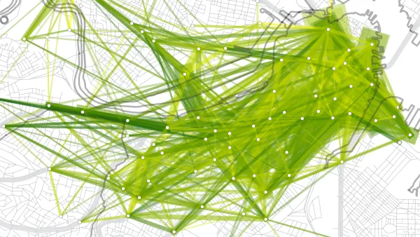
The Year's Best in Big Data
The "Best of" roll continues with Emily Badger's list of the most useful tools, maps and data visualizations to make use of municipal open data over the past year.
The Promise and Perils of Modern Disaster Communications
During and after Sandy, transportation workers had the responsibility of informing riders of changing conditions and schedules. Ray Rivera compares the different communication approaches of New Jersey Transit and the Long Island Rail Road.
What's in a Name?
"Detroit is the Paris of the Widwest", "Oakland is the Newark of the West Coast", "Chattanooga is the Cleveland of the Southeast" - a new website uses a navigable map of the world to catalog the many "X is the Y of Z" analogies found on Twitter.
The Top Private Sector Trends Changing Our Cities
Max Nisen discusses how cities like Boston and Edmonton are successfully applying popular trends from the private sector - on topics such as mobility, engagement, big data and innovation - and changing the way we live.
Apps for Hailing Cabs Cause Controversy in NYC
NYC's Taxi and Limousine Commission approved a pilot program for apps that will allow users to request a yellow taxi ride on their smartphones rather than having to “raise [their] arms toward oncoming traffic” the old-fashioned way.
Philly Establishes New Office for Civic Innovation
Following Boston's visionary lead, this week Philadelphia Mayor Michael Nutter formally created the city's Office of New Urban Mechanics, "a civic innovation tool for urban transformation.”
Connected Commuters Are Happy Commuters
A new study from the New Cities Foundation suggests that those of us who use transit apps such as Waze and Roadify have shorter and more pleasant commutes.
Six Magnificent Maps of 2012
The "best of 2012" lists are just starting to spread and, already, one of the most unique collections we've come across is Caitlin Dempsey's look at the year's most interesting maps. You don't have to be a cartographer to enjoy these visualizations.
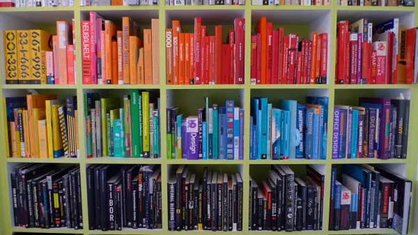
Top 10 Books - 2013
Planetizen is pleased to release its eleventh annual list of the ten best books in urban planning, design and development published in 2012.
Parking App Heads to the Suburbs
Does your town have sensors embedded in the pavement of parking stalls that signal when one becomes available? D.C. and N.Y.C. do - and now Streetline's parking app will allow motorists in San Mateo, pop. 97K and San Carlos, pop. 28K to find parking.
Better Living through Information: Big Data and Urban Systems
The emerging methods of urban governance, planning, design, and management made possible by technological advances in data collection, analysis, and communication promise to make our cities better, and more efficient, places to live. The Urban Systems Collaborative, a unique gathering of voices from academia and industry, is fostering a discussion about improving our cities through technology.

FREE Course: Walkable City 1: Why Walkability?
After describing his path towards focusing on walkability as the essence of good planning, Jeff Speck marches through his five principal reasons for making more walkable places.
Reinventing Malls: Planning Alchemy—Turning Gray Fields Into Gold
The course focuses on the opportunities and imperatives that shape reinvention of mall sites.

City of Rosemead
Rutgers University, Edward J. Bloustein School of Planning and Public Policy
One Hundred Miles
University of Michigan School for Environment and Sustainability (SEAS)
Hunter College, City University of New York (CUNY)
The Architects Foundation
City of Cambridge
Montrose County
The Pocatello Development Authority